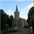
IMAGES TAKEN NEAR TO
Kirkton Of Liff, DUNDEE, DD2 5LX

Introduction

This page details the photographs taken nearby to Kirkton Of Liff, DD2 5LX by members of the Geograph project.

The Geograph project started in 2005 with the aim of publishing, organising and preserving representative images for every square kilometre of Great Britain, Ireland and the Isle of Man.

There are currently over 7.5m images from over14,400 individuals and you can help contribute to the project by visiting https://www.geograph.org.uk

Image Map


Images are licensed for reuse under creativecommons.org/licenses/by-sa/2.0
Notes
  • Clicking on the map will re-center to the selected point.
  • The higher the marker number, the further away the image location is from the centre of the postcode.

Image Listing (16 Images Found)

Images are licensed for reuse under creativecommons.org/licenses/by-sa/2.0
Image
Details
Distance
1
Liff Parish Church
In the small Angus hamlet north of Dundee.
Image: © James Denham Taken: 31 May 2010
0.06 miles
2
Liff Church
Image: © Douglas Nelson Taken: 8 May 2013
0.06 miles
3
Liff Church
Image: © Alex McGregor Taken: 25 Sep 2013
0.06 miles
4
Liff Church
The up for sale Liff Parish Church viewed from near the entrance, with the war memorial to the left.
Image: © Scott Cormie Taken: 26 Jul 2020
0.06 miles
5
The main street in Liff in Angus
Image: © James Denham Taken: 31 May 2010
0.06 miles
6
Liff Church
Image: © Alex McGregor Taken: 25 Sep 2013
0.06 miles
7
Liff Parish Church
The church was built in 1839 and its slender pyramid of a spire is supported by small flying buttresses, just visible at its base in this photograph.
Image: © James Allan Taken: 2 Dec 2013
0.07 miles
8
Liff Park
Image: © Alex McGregor Taken: 25 Sep 2013
0.07 miles
9
Eastern edge of Liff
Looking to the eastern side of Liff from Woodside Road.
Image: © Scott Cormie Taken: 26 Jul 2020
0.11 miles
10
Site of Broch at Hurley Hawkin
The raised part of grass and trees just beyond the lawn is the site of a former broch. It lies within the private ground of a dwellinghouse.
Image: © Douglas Nelson Taken: 27 Mar 2014
0.13 miles