IMAGES TAKEN NEAR TO
Grayhills Walk, DUNDEE, DD2 5FP
Introduction
This page details the photographs taken nearby to Grayhills Walk, DD2 5FP by members of the Geograph project.
The Geograph project started in 2005 with the aim of publishing, organising and preserving representative images for every square kilometre of Great Britain, Ireland and the Isle of Man.

There are currently over 7.5m images from over14,400 individuals and you can help contribute to the project by visiting https://www.geograph.org.uk
Image Map
Images are licensed for reuse under creativecommons.org/licenses/by-sa/2.0
Notes
- Clicking on the map will re-center to the selected point.
- The higher the marker number, the further away the image location is from the centre of the postcode.
Image Listing (18 Images Found)
Images are licensed for reuse under creativecommons.org/licenses/by-sa/2.0
Image
Details
Distance
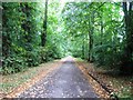
3
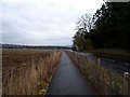
Cycle track to New Mill of Gray
Paralleling the public road.
Image: © James Allan
Taken: 2 Dec 2013
0.11 miles
4
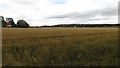
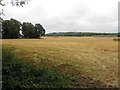
Arable land, Gray
A field of wheat on the edge of Dundee.
Image: © Richard Webb
Taken: 30 Aug 2014
0.11 miles
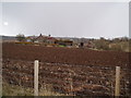
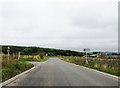
6
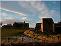
Mill of Gray
Some ruined buildings mixed within a working farm.
Image: © stephen samson
Taken: 10 Feb 2009
0.13 miles
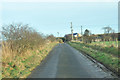
9
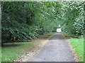
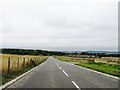
Estate road, Gray
A long straight road which gives a pleasant alternative to the A90 if not motorised.
Image: © Richard Webb
Taken: 30 Aug 2014
0.20 miles