IMAGES TAKEN NEAR TO
Longforgan, DUNDEE, DD2 5EY
Introduction
This page details the photographs taken nearby to DD2 5EY by members of the Geograph project.
The Geograph project started in 2005 with the aim of publishing, organising and preserving representative images for every square kilometre of Great Britain, Ireland and the Isle of Man.

There are currently over 7.5m images from over14,400 individuals and you can help contribute to the project by visiting https://www.geograph.org.uk
Image Map
Images are licensed for reuse under creativecommons.org/licenses/by-sa/2.0
Notes
- Clicking on the map will re-center to the selected point.
- The higher the marker number, the further away the image location is from the centre of the postcode.
Image Listing (8 Images Found)
Images are licensed for reuse under creativecommons.org/licenses/by-sa/2.0
Image
Details
Distance
1

Barn conversion near East Bank.
Old barns being converted beside East Bank Farm. New housing in Longforgan is visible on the skyline.
Image: © Val Vannet
Taken: 18 Jun 2005
0.07 miles
2
Sewer pipe leading into the Longforgan treatment facility
Image: © Dr Duncan Pepper
Taken: 24 Jun 2010
0.14 miles
6
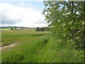
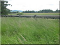
Field edge boundary-Lonforgan in the distance
Image: © Dr Duncan Pepper
Taken: 24 Jun 2010
0.20 miles
7
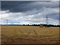
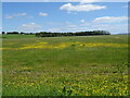
Farmland between East Bank and West Bank near Longforgan
Image: © Douglas Nelson
Taken: 18 Aug 2016
0.20 miles