IMAGES TAKEN NEAR TO
DD2 3YY
Introduction
This page details the photographs taken nearby to DD2 3YY by members of the Geograph project.
The Geograph project started in 2005 with the aim of publishing, organising and preserving representative images for every square kilometre of Great Britain, Ireland and the Isle of Man.

There are currently over 7.5m images from over14,400 individuals and you can help contribute to the project by visiting https://www.geograph.org.uk
Image Map
Images are licensed for reuse under creativecommons.org/licenses/by-sa/2.0
Notes
- Clicking on the map will re-center to the selected point.
- The higher the marker number, the further away the image location is from the centre of the postcode.
Image Listing (15 Images Found)
Images are licensed for reuse under creativecommons.org/licenses/by-sa/2.0
Image
Details
Distance
1
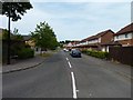
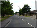
Gullane Avenue
Seen from Rosemount Road.
Image: © James Allan
Taken: 12 Jul 2013
0.05 miles
2
Chalmers-Ardler Church of Scotland, Dundee
Image: © Douglas Nelson
Taken: 6 Apr 2016
0.09 miles
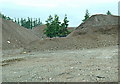
3
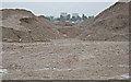
Ardler's last multi
Ardler's last multi is no more.
To complement Val's first geograph this is all that remains of the last Ardler multi, just a pile of crusher run.
The last of the multis was dropped on the 24th June 2007 and converted in recycled concrete for use in building projects.
Image: © Jim Bain
Taken: 6 Aug 2008
0.11 miles
4
Gleneagles Road, Dundee
Junction with Gleneagles Street.
Image: © JThomas
Taken: 13 Jun 2021
0.14 miles
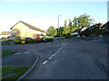
6
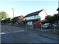
Bungalows in Rosemount Road
A leafy suburban street.
Image: © James Allan
Taken: 12 Jul 2013
0.17 miles
7
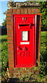
George V postbox on Camperdown Road, Dundee
Postbox No. DD3 229.
Image: © JThomas
Taken: 13 Jun 2021
0.21 miles
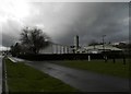
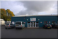
8
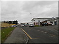
Industrial premises, Faraday Street, Dundee
Image: © Douglas Nelson
Taken: 1 Apr 2016
0.22 miles
9
Pirates Island, Camperdown Road, Dundee
Children's soft play with a pirate theme.
Image: © Mike Pennington
Taken: 20 Oct 2012
0.22 miles
10
Ardler's last multi
To complement Val's first geograph this is all that remains of the last Ardler multi, just a pile of crusher run.
The last of the multis was dropped on the 24th June 2007 and converted in recycled concrete for use in building projects.
Haunting remains include some street lamps, trees, the access road and the signs stating that this end of the multi was once called Baberton Court and Brassie Court.
Image: © Jim Bain
Taken: 6 Aug 2008
0.22 miles