IMAGES TAKEN NEAR TO
Dudhope Street, DUNDEE, DD1 1JT

Introduction

This page details the photographs taken nearby to Dudhope Street, DD1 1JT by members of the Geograph project.

The Geograph project started in 2005 with the aim of publishing, organising and preserving representative images for every square kilometre of Great Britain, Ireland and the Isle of Man.

There are currently over 7.5m images from over14,400 individuals and you can help contribute to the project by visiting https://www.geograph.org.uk

Image Map


Images are licensed for reuse under creativecommons.org/licenses/by-sa/2.0
Notes
  • Clicking on the map will re-center to the selected point.
  • The higher the marker number, the further away the image location is from the centre of the postcode.

Image Listing (221 Images Found)

Images are licensed for reuse under creativecommons.org/licenses/by-sa/2.0
  • ...
Image
Details
Distance
1
Dundee - Hilltown Flats
Landmark tall buildings in central Dundee, between The Law and the city centre. www.dundeecity.gov.uk
Image: © Colin Smith Taken: 2 Jun 2017
0.07 miles
2
Constitution Road, Dundee
Just north of the inner ring road, tenements with impressive chimneys...
Image: © Bill Harrison Taken: 9 Apr 2022
0.09 miles
3
Towerblocks, Hilltown
Image: © Hugh Venables Taken: 21 Apr 2019
0.09 miles
4
Constitution House, Dundee
Originally opened on 13th September 1928 as the Dundee Public Health Institute (at a cost of £14,000). From 1928 to the late 1980s it was a clinic for VD (Sexually Transmitted Diseases) and Pulmonary Medicine. Locally know as either 'The Clap Clinic' or 'The Chest Clinic', it is a local landmark. Constitution House is now owned by NHS Tayside and is a clinic for substance misuse (drugs and alcohol). The Dundee Eating Disorders Clinic is in the basement.
Image: © jamesnicoll Taken: 25 Apr 2009
0.09 miles
5
St Mary Magdalene's Scottish Episcopal Church, Dundee
Built ca. 1867 for the Catholic Apostolic Church (https://en.wikipedia.org/wiki/Catholic_Apostolic_Church ) but the Dundee congregation disbanded in 1945 and the Episcopalians took over the building in 1952: B-listed (LB25113: http://portal.historicenvironment.scot/designation/LB25113 ). The inner ring road passes in front.
Image: © Bill Harrison Taken: 9 Apr 2022
0.10 miles
6
Tower block, Dundee
Image: © JThomas Taken: 23 Oct 2013
0.10 miles
7
Tower block, Hilltown, Dundee
Image: © JThomas Taken: 10 Jun 2021
0.10 miles
8
St. Mary Magdalene's, Dundee
Image: © Dan Taken: 6 Feb 2009
0.11 miles
9
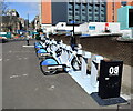
Electric bike hire and charging station, Dundee
Image: © Bill Harrison Taken: 9 Apr 2022
0.11 miles
10
Abertay University, Dundee
For the history of the university, see: https://en.wikipedia.org/wiki/Abertay_University .
Image: © Bill Harrison Taken: 9 Apr 2022
0.11 miles
  • ...