IMAGES TAKEN NEAR TO
Kinnell, ARBROATH, DD11 4UG
Introduction
This page details the photographs taken nearby to DD11 4UG by members of the Geograph project.
The Geograph project started in 2005 with the aim of publishing, organising and preserving representative images for every square kilometre of Great Britain, Ireland and the Isle of Man.

There are currently over 7.5m images from over14,400 individuals and you can help contribute to the project by visiting https://www.geograph.org.uk
Image Map
Images are licensed for reuse under creativecommons.org/licenses/by-sa/2.0
Notes
- Clicking on the map will re-center to the selected point.
- The higher the marker number, the further away the image location is from the centre of the postcode.
Image Listing (5 Images Found)
Images are licensed for reuse under creativecommons.org/licenses/by-sa/2.0
Image
Details
Distance
1
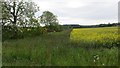
Field margin
A strip left uncultivated beside the Lilylorn Burn.
Image: © Richard Webb
Taken: 16 Jun 2015
0.08 miles
2
Arable land, Burnside
Oilseed rape beside the Lilylorn Burn.
Image: © Richard Webb
Taken: 16 Jun 2015
0.10 miles
3
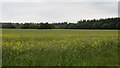
Oilseed rape near Burnside
Very flat land here.
Image: © Richard Webb
Taken: 16 Jun 2015
0.11 miles
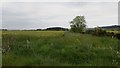
4
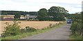
Burnside
There is even a local bus service on this back road at Kinnell.
Image: © Anne Burgess
Taken: 3 Aug 2006
0.12 miles
5
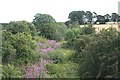
Railway Line
This was part of the railway line from Bridge of Dun to Arbroath via Friockheim.
Image: © Anne Burgess
Taken: 3 Aug 2006
0.18 miles