
IMAGES TAKEN NEAR TO
Gardyne Street, ARBROATH, DD11 4SW
Introduction
This page details the photographs taken nearby to Gardyne Street, DD11 4SW by members of the Geograph project.
The Geograph project started in 2005 with the aim of publishing, organising and preserving representative images for every square kilometre of Great Britain, Ireland and the Isle of Man.

There are currently over 7.5m images from over14,400 individuals and you can help contribute to the project by visiting https://www.geograph.org.uk
Image Map
Images are licensed for reuse under creativecommons.org/licenses/by-sa/2.0
Notes
- Clicking on the map will re-center to the selected point.
- The higher the marker number, the further away the image location is from the centre of the postcode.
Image Listing (13 Images Found)
Images are licensed for reuse under creativecommons.org/licenses/by-sa/2.0
Image
Details
Distance
2
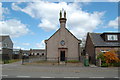
Masonic Lodge, Friockheim, Angus
The Bruce No.593, Masonic Lodge Gardyne Street, Friockheim, DD11 4SP.
Image: © Jim Campbell
Taken: 15 May 2010
0.07 miles
3
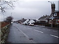
Gardyne Street, Friockheim
At the eastern end of Friockheim
Image: © Douglas Nelson
Taken: 4 Jan 2018
0.07 miles
4
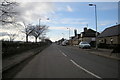
Gardyne Street, Friockheim near its junction with Union Street
Picture taken looking west.
Image: © Alan Morrison
Taken: 5 Mar 2009
0.08 miles
5
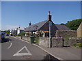
Cottage on Westgate, Friockheim
Seen from the junction with Gardyne Street (B965).
Image: © Stanley Howe
Taken: 4 Jul 2015
0.13 miles
6
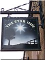
Sign for the Star Inn
Originally a religious symbol, referring either to the star of Bethlehem or to the Virgin Mary, one of whose titles is 'the Star of the Sea'. The Star as a pub names dates from the 15th century.
Image: © Maigheach-gheal
Taken: 5 Oct 2009
0.16 miles
8
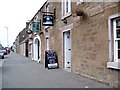
Street Scene, Friockheim
Looking along the B965, Gardyne Street showing some of the local shops and the Star Inn.
Image: © Maigheach-gheal
Taken: 5 Oct 2009
0.19 miles
9
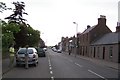
Gardyne Street
This is Friockheim's main street, which is a shadow of its former self. Friockheim
Angus
Station Road, Friockheim
©1995-2006 Gazetteer for Scotland
An agricultural and commuter village in Angus, situated to the south of the Lunan Water 6 miles (9½ km) north west of Arbroath. Probably the only example of a Gaelic-German place-name, it was created as a set of feus for textile workers on the lands of Friock Mains in 1830. The German suffix was added by the local laird in recognition of the textile manufacturing skills he had encountered in Germany. The prosperity of the village was enhanced with the arrival of the Arbroath and Forfar Railway in 1839 and the Aberdeen Railway in 1850 which made it a transit centre
http://www.geo.ed.ac.uk/scotgaz/towns/townfirst393.html
Image: © Dominic Dawn Harry and Jacob Paterson
Taken: 7 Jun 2006
0.21 miles
10
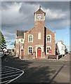
Friockheim and Kinnell Parish Kirk
The kirk stands at the angle where Station Road forks to form Gardyne Street to the right and Millgate to the left. The kirk dates from 1835 and cost £432 to build. Its denomination is Church of Scotland.
Image: © Anne Burgess
Taken: 12 Aug 2009
0.21 miles