
IMAGES TAKEN NEAR TO
ARBROATH, DD11 2QT
Introduction
This page details the photographs taken nearby to DD11 2QT by members of the Geograph project.
The Geograph project started in 2005 with the aim of publishing, organising and preserving representative images for every square kilometre of Great Britain, Ireland and the Isle of Man.

There are currently over 7.5m images from over14,400 individuals and you can help contribute to the project by visiting https://www.geograph.org.uk
Image Map
Images are licensed for reuse under creativecommons.org/licenses/by-sa/2.0
Notes
- Clicking on the map will re-center to the selected point.
- The higher the marker number, the further away the image location is from the centre of the postcode.
Image Listing (2 Images Found)
Images are licensed for reuse under creativecommons.org/licenses/by-sa/2.0
Image
Details
Distance
1
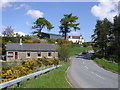
Crombie Mill
The house and buildings on the skyline are what remains of the former Crombie Mill. The view is taken in the south west corner of the grid box from the B961 where it crosses the Crombie Burn (see another image for this grid square)
Image: © Val Vannet
Taken: 21 May 2005
0.22 miles
2
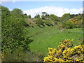
Crombie Burn
The Crombie Burn drains a valley which clearly was eroded by a bigger river than occupies it today. This view is taken from the B961 in the south west corner of the grid box and looks north west up the valley. Out of view is Crombie Reservoir (NO5240) which was built in the 1860s to provide water for Dundee. At that time the Crombie Burn was dammed and the river reduced to its present small dimensions.
Image: © Val Vannet
Taken: 21 May 2005
0.22 miles