IMAGES TAKEN NEAR TO
ARBROATH, DD11 2PJ
Introduction
This page details the photographs taken nearby to DD11 2PJ by members of the Geograph project.
The Geograph project started in 2005 with the aim of publishing, organising and preserving representative images for every square kilometre of Great Britain, Ireland and the Isle of Man.

There are currently over 7.5m images from over14,400 individuals and you can help contribute to the project by visiting https://www.geograph.org.uk
Image Map
Images are licensed for reuse under creativecommons.org/licenses/by-sa/2.0
Notes
- Clicking on the map will re-center to the selected point.
- The higher the marker number, the further away the image location is from the centre of the postcode.
Image Listing (11 Images Found)
Images are licensed for reuse under creativecommons.org/licenses/by-sa/2.0
Image
Details
Distance
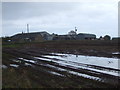
2
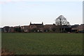
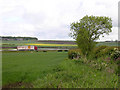
Nether Kelly
Farm, as seen from the cycle path along the A92.
Image: © Richard Webb
Taken: 7 Sep 2009
0.04 miles
5
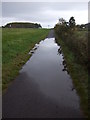
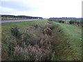
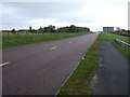
Standing water on National Cycle Route 1
Heading east towards Arbroath.
Image: © JThomas
Taken: 23 Oct 2013
0.12 miles
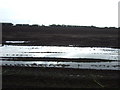
8
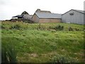
A92 near Nether Kelly
The view is taken from the dog leg in the track in the southern part of the grid box and looks towards the busy A92 which is currently (2005) being up-graded to dual carriageway. The small settlement of Easter Knox NO5939 is on the hill in front of the woodland.
Image: © Val Vannet
Taken: 30 May 2005
0.16 miles