IMAGES TAKEN NEAR TO
ARBROATH, DD11 2PG
Introduction
This page details the photographs taken nearby to DD11 2PG by members of the Geograph project.
The Geograph project started in 2005 with the aim of publishing, organising and preserving representative images for every square kilometre of Great Britain, Ireland and the Isle of Man.

There are currently over 7.5m images from over14,400 individuals and you can help contribute to the project by visiting https://www.geograph.org.uk
Image Map
Images are licensed for reuse under creativecommons.org/licenses/by-sa/2.0
Notes
- Clicking on the map will re-center to the selected point.
- The higher the marker number, the further away the image location is from the centre of the postcode.
Image Listing (15 Images Found)
Images are licensed for reuse under creativecommons.org/licenses/by-sa/2.0
Image
Details
Distance
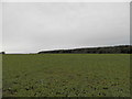
1
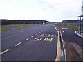
Bus Stop on the New A92 Arbroath to Dundee Dual Carriageway
Image: © Dominic Dawn Harry and Jacob Paterson
Taken: 24 Feb 2006
0.08 miles
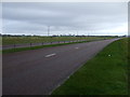
2
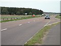
A92, Three Mile Wood
Dundee - Arbroath road, now a dual carriageway.
Image: © Richard Webb
Taken: 7 Sep 2009
0.09 miles
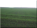
3
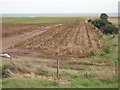
Potato field, Nether Kelly
The leaves have been killed off by spraying with sulphuric acid prior to harvest.
Image: © Richard Webb
Taken: 7 Sep 2009
0.13 miles
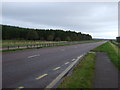
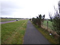
5
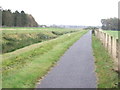
National Cycle Route 1
Heading east beside the A92.
Image: © JThomas
Taken: 23 Oct 2013
0.15 miles
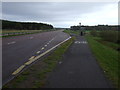
9
National Cycle Route 1
Heading east beside the A92.
Image: © JThomas
Taken: 23 Oct 2013
0.17 miles
10
Bus stop off the A92
National Cycle Route 1.
Image: © JThomas
Taken: 23 Oct 2013
0.19 miles