
IMAGES TAKEN NEAR TO
Grant Road, ARBROATH, DD11 1JU
Introduction
This page details the photographs taken nearby to Grant Road, DD11 1JU by members of the Geograph project.
The Geograph project started in 2005 with the aim of publishing, organising and preserving representative images for every square kilometre of Great Britain, Ireland and the Isle of Man.

There are currently over 7.5m images from over14,400 individuals and you can help contribute to the project by visiting https://www.geograph.org.uk
Image Map
Images are licensed for reuse under creativecommons.org/licenses/by-sa/2.0
Notes
- Clicking on the map will re-center to the selected point.
- The higher the marker number, the further away the image location is from the centre of the postcode.
Image Listing (110 Images Found)
Images are licensed for reuse under creativecommons.org/licenses/by-sa/2.0
Image
Details
Distance
1
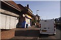
Shop, Grant Road
On a distribution road which runs beside the A92.
Image: © Richard Webb
Taken: 23 Sep 2017
0.02 miles
2
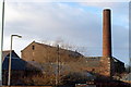
Disused Factory in Arbroath
I believe this to be the factory of Giddings & Lewis. Picture taken from High Road Bridge, Arbroath.
Image: © Alan Morrison
Taken: 6 Feb 2009
0.06 miles
3
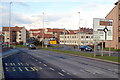
Guthrie Port Roundabout, Arbroath
Picture taken from Burnside Drive.
Image: © Alan Morrison
Taken: 6 Feb 2009
0.08 miles
4
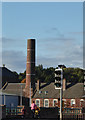
Former mill, arbroath
This is part of Baltic Works. Built 1854 with a neoclassical main block (just seen on the left) with three pediments and a wrought iron roof. There is a large beam engine house to the rear (I believe this is the upper roof line behind and extending to the left of the chimney) and a truncated circular brick chimney on a square stone plinth. Built for weaving until 1932 then a whisky bond. Now at least part converted for housing.
Image: © Chris Allen
Taken: 21 Oct 2016
0.09 miles
5
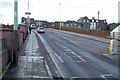
High Road Bridge, Arbroath
The Bridge carries traffic across the Arbroath / Montrose Railway line
Image: © Alan Morrison
Taken: 6 Feb 2009
0.10 miles
6
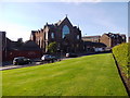
St Andrews Parish church on Hamilton Place, Arbroath
Viewed from Arbroath Abbey Pert. See http://www.scottishchurches.org.uk/sites/site/id/7870/name/St+Andrews+Parish+Church%2C+Arbroath+Arbroath+and+St+Vigeans+Tayside
Image: © Stanley Howe
Taken: 12 Aug 2015
0.10 miles
7
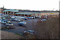
Morrisons Supermarket, Arbroath
Picture taken from High Road Bridge.
Image: © Alan Morrison
Taken: 6 Feb 2009
0.11 miles
8
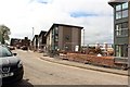
Barn Green, Arbroath
A new development of council owned social housing is being built on the right hand side of the road.
Image: © Graham Robson
Taken: 29 Apr 2019
0.11 miles
9
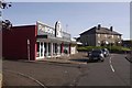
Pie Bob's Bakery
On Grant Road, Arbroath.
Image: © Richard Webb
Taken: 23 Sep 2017
0.11 miles
10
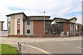
Housing development, Barn Green, Arbroath
A new council owned social housing scheme consisting of flats and house is under construction on Barn Green in Arbroath.
Image: © Graham Robson
Taken: 29 Apr 2019
0.11 miles