IMAGES TAKEN NEAR TO
Burnside Drive, ARBROATH, DD11 1GY
Introduction
This page details the photographs taken nearby to Burnside Drive, DD11 1GY by members of the Geograph project.
The Geograph project started in 2005 with the aim of publishing, organising and preserving representative images for every square kilometre of Great Britain, Ireland and the Isle of Man.

There are currently over 7.5m images from over14,400 individuals and you can help contribute to the project by visiting https://www.geograph.org.uk
Image Map
Images are licensed for reuse under creativecommons.org/licenses/by-sa/2.0
Notes
- Clicking on the map will re-center to the selected point.
- The higher the marker number, the further away the image location is from the centre of the postcode.
Image Listing (355 Images Found)
Images are licensed for reuse under creativecommons.org/licenses/by-sa/2.0
Image
Details
Distance
1
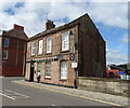
Arbroath Herald
The local newspaper offices.
Image: © John M
Taken: 15 Jul 2007
0.01 miles
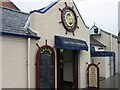
3
Kingdom Hall, Jehovah's Witnesses
By A92 through Arbroath.
Image: © Stanley Howe
Taken: 18 Nov 2015
0.05 miles
4
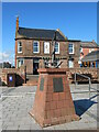
Westhaven memorial by the harbour
The Westhaven was an Arbroath fishing boat that was lost at sea on 10th March 1997 with the loss of four crew. The circumstances were not associated with bad weather, but because fishing gear had become trapped in an underwater obstacle [a pipeline] and the boat capsized.
Image: © Gordon Hatton
Taken: 13 Sep 2021
0.06 miles
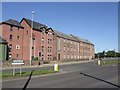
5
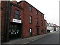
Former drill hall in Marketgate, Arbroath
Now house Arbroath Community Centre
Image: © Douglas Nelson
Taken: 3 Sep 2014
0.06 miles
6
Former drill hall in Marketgate, Arbroath
Now used as a community centre
Image: © Douglas Nelson
Taken: 3 Sep 2014
0.06 miles
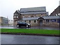
7
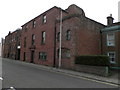
Marketgate
One of the older streets, much of which has escaped the modernisation that has torn the heart out of the town centre. The large sandstone building is the Image
Image: © Anne Burgess
Taken: 18 Aug 2014
0.06 miles
8
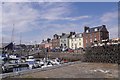
Arbroath Harbour
A row of buildings includes an excellent ice cream shop and very fine chippy.
Image: © Richard Webb
Taken: 27 Aug 2016
0.06 miles
9
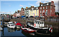
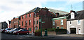
Inmost Harbour
This is named as 'Wet Dock' on the map, to distinguish it from the Tidal Harbour. Much of it is now a marina, but a few working boats are still in evidence.
Image: © Anne Burgess
Taken: 18 Aug 2014
0.06 miles