IMAGES TAKEN NEAR TO
Burnside Place, MONTROSE, DD10 9RB
Introduction
This page details the photographs taken nearby to Burnside Place, DD10 9RB by members of the Geograph project.
The Geograph project started in 2005 with the aim of publishing, organising and preserving representative images for every square kilometre of Great Britain, Ireland and the Isle of Man.

There are currently over 7.5m images from over14,400 individuals and you can help contribute to the project by visiting https://www.geograph.org.uk
Image Map
Images are licensed for reuse under creativecommons.org/licenses/by-sa/2.0
Notes
- Clicking on the map will re-center to the selected point.
- The higher the marker number, the further away the image location is from the centre of the postcode.
Image Listing (55 Images Found)
Images are licensed for reuse under creativecommons.org/licenses/by-sa/2.0
Image
Details
Distance
2

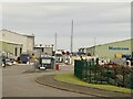
Burnside Place, Ferryden
Docks and industry, mostly offshore on the left.
Image: © Richard Webb
Taken: 27 Sep 2014
0.06 miles
3
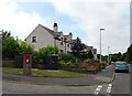
Houses on Burnside Place, Ferryden
Showing position of Postbox No. DD10 68.
See Image] for postbox.
Image: © JThomas
Taken: 20 Jul 2021
0.07 miles
4
Port entrance, Montrose
On the south side of the Esk, some on land reclaimed from the southern exit from Montrose Basin. Mostly offshore energy interests, usually oil but wind farms are now represented as well.
Image: © Richard Webb
Taken: 22 Jul 2024
0.07 miles
5
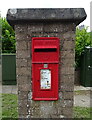
Elizabethan postbox on Burnside Place, Ferryden
Postbox No. DD10 68.
See Image] for context.
Image: © JThomas
Taken: 20 Jul 2021
0.09 miles
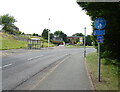
6
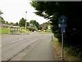
Burnside Place
The road out of Ferryden, approaching the A92.
Image: © Richard Webb
Taken: 22 Jul 2024
0.12 miles
8
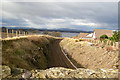
Dundee / Aberdeen Railway, at Ferryden, looking north
Picture taken from the bridge on the Dunninald / Ferryden road.
Image: © Alan Morrison
Taken: 26 Feb 2009
0.12 miles
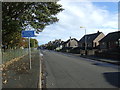
10
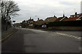
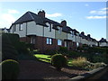
Burnside Place and Ogilvie Place, Ferryden, at its junction with Craig Road
Image: © Alan Morrison
Taken: 27 Dec 2008
0.12 miles