IMAGES TAKEN NEAR TO
Craigo, MONTROSE, DD10 9JZ
Introduction
This page details the photographs taken nearby to DD10 9JZ by members of the Geograph project.
The Geograph project started in 2005 with the aim of publishing, organising and preserving representative images for every square kilometre of Great Britain, Ireland and the Isle of Man.

There are currently over 7.5m images from over14,400 individuals and you can help contribute to the project by visiting https://www.geograph.org.uk
Image Map
Images are licensed for reuse under creativecommons.org/licenses/by-sa/2.0
Notes
- Clicking on the map will re-center to the selected point.
- The higher the marker number, the further away the image location is from the centre of the postcode.
Image Listing (5 Images Found)
Images are licensed for reuse under creativecommons.org/licenses/by-sa/2.0
Image
Details
Distance
3
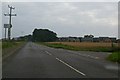
Crossing at former Craigo station, 1988
View eastward, across the ex-NBR Dundee - Montrose - Aberdeen main line. Craigo station was closed to passengers from 11/6/56, to goods from 7/11/77.
Image: © Ben Brooksbank
Taken: 21 Jun 1988
0.13 miles
4
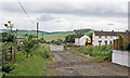
Marykirk / Hillside Road at its junction with the road leading to Logie Pert
Image: © Alan Morrison
Taken: 30 Aug 2007
0.16 miles
5
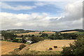
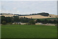
Farmland, Craigo, beside the River North Esk
Image: © David Robinson
Taken: 13 Sep 2018
0.25 miles