IMAGES TAKEN NEAR TO
Main Road, MONTROSE, DD10 9HT
Introduction
This page details the photographs taken nearby to Main Road, DD10 9HT by members of the Geograph project.
The Geograph project started in 2005 with the aim of publishing, organising and preserving representative images for every square kilometre of Great Britain, Ireland and the Isle of Man.

There are currently over 7.5m images from over14,400 individuals and you can help contribute to the project by visiting https://www.geograph.org.uk
Image Map
Images are licensed for reuse under creativecommons.org/licenses/by-sa/2.0
Notes
- Clicking on the map will re-center to the selected point.
- The higher the marker number, the further away the image location is from the centre of the postcode.
Image Listing (14 Images Found)
Images are licensed for reuse under creativecommons.org/licenses/by-sa/2.0
Image
Details
Distance
1
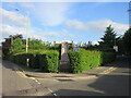
Hillside Parish War Memorial
The William Lamb sculpted war memorial in Hillside, on the apex of Main Road and Rosemount Road.
Image: © Scott Cormie
Taken: 12 Jun 2021
0.07 miles
2
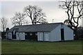
Hillside Scouts
The scout hut at Hillside located on a park near woodland.
Image: © Andrew Wood
Taken: 21 Jan 2017
0.15 miles
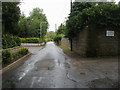
3
Hospital Road Hillside, Montrose at its junction with the south entrance to Sunnyside Royal Hospital
Image: © Alan Morrison
Taken: 13 Feb 2009
0.17 miles
4
Dubton Road, Hillside
Heading west beside the disused railway embankment.
Image: © JThomas
Taken: 11 Nov 2013
0.17 miles
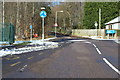
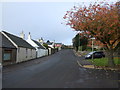
5
Dubton Road, Hillside
Looking south-westward.
Image: © Peter Wood
Taken: 8 Aug 2021
0.17 miles
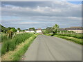
6
Lamondfauld Road
Lamondfauld Road heading to Dubton Road
Image: © Shaun Ferguson
Taken: 18 Aug 2011
0.18 miles
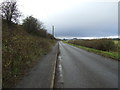
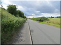
9
C39 (Angus) Dubton Road
The C39 Dubton Road heading west from Hillside.
Image: © Scott Cormie
Taken: 12 Jun 2021
0.21 miles
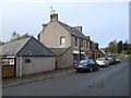
10
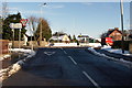
Approaching a Road Junction in Hillside Village, Montrose, from Dubton Road
Image: © Alan Morrison
Taken: 13 Feb 2009
0.23 miles