IMAGES TAKEN NEAR TO
Broomfield Gardens, Broomfield Road, MONTROSE, DD10 8SQ
Introduction
This page details the photographs taken nearby to Broomfield Gardens, Broomfield Road, DD10 8SQ by members of the Geograph project.
The Geograph project started in 2005 with the aim of publishing, organising and preserving representative images for every square kilometre of Great Britain, Ireland and the Isle of Man.

There are currently over 7.5m images from over14,400 individuals and you can help contribute to the project by visiting https://www.geograph.org.uk
Image Map
Images are licensed for reuse under creativecommons.org/licenses/by-sa/2.0
Notes
- Clicking on the map will re-center to the selected point.
- The higher the marker number, the further away the image location is from the centre of the postcode.
Image Listing (39 Images Found)
Images are licensed for reuse under creativecommons.org/licenses/by-sa/2.0
Image
Details
Distance
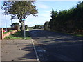
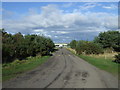
1
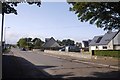
Broomfield Road, Montrose
Heading off the Links.
Image: © Richard Webb
Taken: 23 Sep 2017
0.03 miles
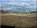
3
Broomfield Industrial Estate and Business Centre
Built on the site of an airfield which saw action in both World Wars. A mix of new buildings and refurbished hangars.
Image: © Richard Webb
Taken: 21 Sep 2009
0.05 miles
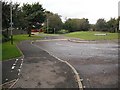
4
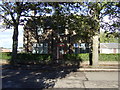
Broomfield Resource Centre
On Broomfield Road.
Image: © JThomas
Taken: 23 Oct 2013
0.05 miles
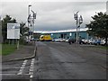
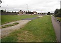
5
National Cycle Route 1
Heading east on Broomfield Road.
Image: © JThomas
Taken: 23 Oct 2013
0.07 miles
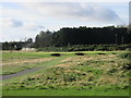
6
Rose Hill
The path is now used by National Cycle Route 1, but was originally a branch of the Aberdeen Railway serving Montrose. Closed along with the station in favour of the current station on a through route.
Image: © Richard Webb
Taken: 21 Sep 2009
0.10 miles
7
NCN 1, Bloomfield Crescent
Route 1 of the National Cycle Network uses the trackbed of the Montrose Branch of the Caledonian Railway. Montrose used to be served by two stations. The current one belonged to the North British.
Image: © Richard Webb
Taken: 21 Sep 2009
0.11 miles
8
Montrose Golf Links, 1562 Course, 12th Hole, Pouderie
The short twelfth hole on the 1562 Course from tee to green.
Image: © Scott Cormie
Taken: 10 Oct 2019
0.12 miles
9

India Shed
Built in 1913 this is one of the three original hangars on Montrose airfield. Now part of an industrial estate they are still in use although not sadly housing aircraft.
Image: © Andrew Wood
Taken: 16 May 2015
0.15 miles
10
National Cycle Route 1
Heading north near North Links Golf Course.
Image: © JThomas
Taken: 23 Oct 2013
0.15 miles