
IMAGES TAKEN NEAR TO
South Links, MONTROSE, DD10 8EJ
Introduction
This page details the photographs taken nearby to South Links, DD10 8EJ by members of the Geograph project.
The Geograph project started in 2005 with the aim of publishing, organising and preserving representative images for every square kilometre of Great Britain, Ireland and the Isle of Man.

There are currently over 7.5m images from over14,400 individuals and you can help contribute to the project by visiting https://www.geograph.org.uk
Image Map
Images are licensed for reuse under creativecommons.org/licenses/by-sa/2.0
Notes
- Clicking on the map will re-center to the selected point.
- The higher the marker number, the further away the image location is from the centre of the postcode.
Image Listing (46 Images Found)
Images are licensed for reuse under creativecommons.org/licenses/by-sa/2.0
Image
Details
Distance
1
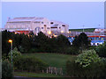
Pharmaceutical Plant at Montrose
Glaxo Smith-Kline is probably the largest drug manufacturers
in Britain.
Image: © Ann Harrison
Taken: 11 May 2009
0.08 miles
2
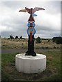
National Cycle Network signpost, Montrose Links
Colourfully painted. On NCN route 1.
Image: © Richard Webb
Taken: 21 Sep 2009
0.09 miles
3
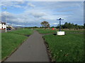
Cycle path on disused railway
National Cycle Route 1 heading north.
Image: © JThomas
Taken: 23 Oct 2013
0.10 miles
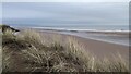
5
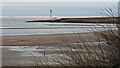
View of Lighthouse and Scurdie Rock, Montrose
Image: © Bartolo Creations
Taken: 1 Jan 2023
0.12 miles
6
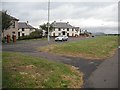
Faulds Road
Houses seen from a former railway line, now National Cycle Route 1 which runs along Montrose Links. The railway was the Aberdeen Railway which was eventually part of the Caledonian Railway and provided an alternative service to the North British. Montrose then had two stations. As this was a branch line, it was closed in favour of the other through route which today carries the town's station.
Image: © Richard Webb
Taken: 21 Sep 2009
0.12 miles
10
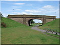
Cycle path beneath Marine Drive
Follows the line of an old rail track that once served the docks.
Image: © Stanley Howe
Taken: 31 Jul 2007
0.13 miles