
IMAGES TAKEN NEAR TO
Woodpecker Drive, GREENHITHE, DA9 9TX
Introduction
This page details the photographs taken nearby to Woodpecker Drive, DA9 9TX by members of the Geograph project.
The Geograph project started in 2005 with the aim of publishing, organising and preserving representative images for every square kilometre of Great Britain, Ireland and the Isle of Man.

There are currently over 7.5m images from over14,400 individuals and you can help contribute to the project by visiting https://www.geograph.org.uk
Image Map
Images are licensed for reuse under creativecommons.org/licenses/by-sa/2.0
Notes
- Clicking on the map will re-center to the selected point.
- The higher the marker number, the further away the image location is from the centre of the postcode.
Image Listing (23 Images Found)
Images are licensed for reuse under creativecommons.org/licenses/by-sa/2.0
Image
Details
Distance
1
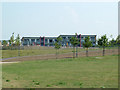
Fusion Apartments at Waterstone Park
The new development Fusion at Waterstone Park has its own play area and access to the common grassed area shared with Sandpiper Close Image Overlooking the Bluewater complex to the south and the Thames to the north most of the residents have a panoramic view.
Image: © Ken Brown
Taken: 28 Jul 2008
0.05 miles
2
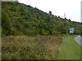
Overgrown former chalk quarry near Bluewater, Kent
Image: © Richard Humphrey
Taken: 7 Sep 2014
0.07 miles
3
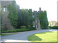
Stone Castle
12th Century Stone Castle. All that remains of the original castle is the tower. It is now used as a banqueting suite for private functions. Taken from the private road to the east.
Image: © Ken Brown
Taken: 9 Jun 2008
0.11 miles
4
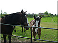
Gypsy Horses
On the unnamed road Image from London Road, Greenhithe towards the new ‘Fusion' development on Waterstone Park a pleasing view is to be had on the right looking towards the rear of the bungalows in Barnfield Close, Horns Cross. Gypsy horses, probably 20 in all. A footpath runs from this point across the field to join up with the close.
Image: © Ken Brown
Taken: 4 May 2008
0.11 miles
5
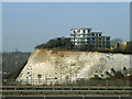
Flats overlooking Bluewater
Perched above the old chalk quarry now housing Bluewater shopping centre, this block is quite new. It hides a very similar block, but not as high, a little further north.
Image: © Robin Webster
Taken: 1 Mar 2012
0.15 miles
6
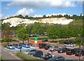
I was pleasantly surprised
My first visit to Bluewater. I was expecting much worse but then perhaps the lack of people made it a more tolerable experience. View from the car park by John Lewis.
Image: © Fernweh
Taken: 28 Aug 2012
0.15 miles
7
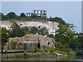
Building on the former quarry edge, Bluewater Shopping Centre
The massive shopping centre called Bluewater was built in a chalk quarry formerly operated and owned by Blue Circle Industries (Cement)
For a view from the top of the cliff see http://www.geograph.org.uk/photo/894673
Image: © Richard Humphrey
Taken: 7 Sep 2014
0.16 miles
8

Christmas Reindeer on Roundabout
Christmas lights in Bluewater Shopping Centre. Seen from John Lewis's Carpark.
On Bluewater Parkway which surrounds the Centre. Trees on Chestnut Avenue towards the Centre.
Image: © David Anstiss
Taken: 18 Dec 2008
0.18 miles
9
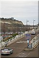
Guildhall Upper Level Ramp and the White Cliffs
Bluewater Shopping Centre
Image: © John Myers
Taken: 7 Jan 2013
0.18 miles
10
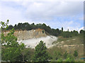
Chalk Cliff, Bluewater Centre, Dartford, Kent
Shown here is the northern rim of the old chalk quarry which now houses the massive Bluewater Shopping Centre.
Image: © John Winfield
Taken: 4 Aug 2005
0.18 miles