
IMAGES TAKEN NEAR TO
Chichester Road, GREENHITHE, DA9 9JS
Introduction
This page details the photographs taken nearby to Chichester Road, DA9 9JS by members of the Geograph project.
The Geograph project started in 2005 with the aim of publishing, organising and preserving representative images for every square kilometre of Great Britain, Ireland and the Isle of Man.

There are currently over 7.5m images from over14,400 individuals and you can help contribute to the project by visiting https://www.geograph.org.uk
Image Map
Images are licensed for reuse under creativecommons.org/licenses/by-sa/2.0
Notes
- Clicking on the map will re-center to the selected point.
- The higher the marker number, the further away the image location is from the centre of the postcode.
Image Listing (106 Images Found)
Images are licensed for reuse under creativecommons.org/licenses/by-sa/2.0
Image
Details
Distance

3
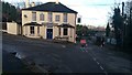
Lads Of The Village, Stone
Image taken on 26 December 2017.
Traditional pub near to Stone Crossing Railway Station. Earlier this year, the owners submitted a planning application (subsequently withdrawn) to develop housing on the car park, to the left of this picture.
The road closure to the right of the pub is in connection with the construction of a footbridge over the railway line which will eventually replace the level crossing.
Image: © Andy Clark
Taken: 26 Dec 2017
0.04 miles
4
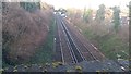
Footbridge Under Construction at Stone Crossing Railway Station
Image taken on 26 December 2017 looking west along the track from the footbridge east of the station.
This footbridge will replace the level crossing and is due to be in use by early 2018.
http://www.kentonline.co.uk/dartford/news/footbridge-lowered-into-place-during-156988/
Image: © Andy Clark
Taken: 26 Dec 2017
0.04 miles
5

Stone Rise Development
On the Horns Cross Junction Opposite The Bull Image is the new development by Countryside called Stone Rise. As part of the regeneration of the Thames Gateway it is ideally situated on the A226 with access to Dartford Town to the west and Greenhithe Station the east.
Image: © Ken Brown
Taken: 4 Aug 2008
0.04 miles
6

New dwellings on Stone Place Road
Image: © Oast House Archive
Taken: 12 Aug 2011
0.05 miles
7

Stone (Kent) speed camera
On London Road.
Image: © Steve Fareham
Taken: 7 May 2009
0.06 miles
8

The Bull Public House, London Road, Stone
Image: © PAUL FARMER
Taken: 25 Sep 2011
0.08 miles

