IMAGES TAKEN NEAR TO
Reed Court, GREENHITHE, DA9 9FT
Introduction
This page details the photographs taken nearby to Reed Court, DA9 9FT by members of the Geograph project.
The Geograph project started in 2005 with the aim of publishing, organising and preserving representative images for every square kilometre of Great Britain, Ireland and the Isle of Man.

There are currently over 7.5m images from over14,400 individuals and you can help contribute to the project by visiting https://www.geograph.org.uk
Image Map
Images are licensed for reuse under creativecommons.org/licenses/by-sa/2.0
Notes
- Clicking on the map will re-center to the selected point.
- The higher the marker number, the further away the image location is from the centre of the postcode.
Image Listing (55 Images Found)
Images are licensed for reuse under creativecommons.org/licenses/by-sa/2.0
Image
Details
Distance
1
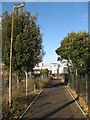
Footpath by Swanscombe Marshes
Building of the new housing estate has resulted in this footpath receiving a fine finish.
Image: © Jonathan Wilkins
Taken: 25 Nov 2017
0.03 miles
2
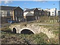
Old bridge
A redundant bridge over a drain on the edge of the marshes is disused and protected by barriers, but a fine piece of vernacular architecture with brick arches and flint rubble facings.
Image: © Jonathan Wilkins
Taken: 25 Nov 2017
0.03 miles
3

Empire Way, Ingress Park
More housing in the vicinity of the Tudor Mound.
Image: © David Kemp
Taken: 5 Oct 2016
0.04 miles
4
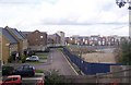
Ingress Park construction site
This large housing estate built by Crest Nicholson is partial completed and houses are already inhabited. Seen from Lover's Lane (a footpath) from the A226 London Road to the River Thames. The area on the right is the contractors parking area.
Image: © David Anstiss
Taken: 23 Oct 2009
0.04 miles
5
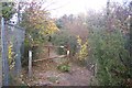
Footpath junction on Lover's Lane
A path from the A226 London Road leads up Lover's Lane towards the River Thames. Another path heads right towards Manor Way through a former cement works land. The fence on the left is a boundary fence on the Ingress Park construction site.
Image: © David Anstiss
Taken: 23 Oct 2009
0.04 miles
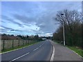
7
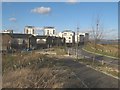
Edge of the estate
Intriguing multi-storey development on the edge of the Swanscombe Marshes. I liked the river view from this slightly elevated position.
Image: © Jonathan Wilkins
Taken: 25 Nov 2017
0.06 miles
8
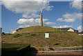
The Tudor Mound and Hermits Cave, Ingress Park
Despite its name the Tudor Mound post-dates the Tudor period and is not a natural feature. The Hermits Cave is marked by the spire-like structure at the top and is one of the follies associated with the nearby Ingress Abbey. The Mound is surrounded by a considerable amount of recently constructed housing Image some of which can be seen in the background.
Image: © David Kemp
Taken: 5 Oct 2016
0.07 miles
9
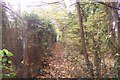
Footpath on Lover's Lane
This path leads from the A226 London Road towards the River Thames. The fence on the left is the boundary fence of Ingress Park construction site.
Image: © David Anstiss
Taken: 23 Oct 2009
0.07 miles