
IMAGES TAKEN NEAR TO
Portland Place, GREENHITHE, DA9 9FE
Introduction
This page details the photographs taken nearby to Portland Place, DA9 9FE by members of the Geograph project.
The Geograph project started in 2005 with the aim of publishing, organising and preserving representative images for every square kilometre of Great Britain, Ireland and the Isle of Man.

There are currently over 7.5m images from over14,400 individuals and you can help contribute to the project by visiting https://www.geograph.org.uk
Image Map
Images are licensed for reuse under creativecommons.org/licenses/by-sa/2.0
Notes
- Clicking on the map will re-center to the selected point.
- The higher the marker number, the further away the image location is from the centre of the postcode.
Image Listing (62 Images Found)
Images are licensed for reuse under creativecommons.org/licenses/by-sa/2.0
Image
Details
Distance
1
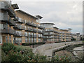
New apartments
Apartments on Portland Place, overlooking the River Thames.
Image: © Oast House Archive
Taken: 12 Aug 2011
0.01 miles

4
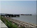
Jaded Jetty
The remains of an abandoned Jetty to the east of Greenhithe. It would have probably served the paper mill that was once nearby. The photograph was taken looking back towards Greenhithe. The QE2 bridge is in the background.
Image: © Glyn Baker
Taken: 4 Sep 2005
0.04 miles
5
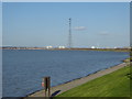
The riverside at Ingress Park
This is the view from the riverfront at Ingress Park near Greenhithe. Swanscombe Pylon dominates the scene, which at 623 feet is, along with its twin across the Thames at West Thurrock, the highest in the UK and the second highest in Europe. See http://www.geograph.org.uk/photo/1669490 for the view from beneath. The tower blocks beyond are at Grays in Essex.
Image: © Marathon
Taken: 24 Mar 2019
0.05 miles
6
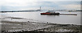
River Thames by old Paper Mills Wharf
Looking from beside Carmichael road towards the Queen Elizabeth II bridge.
Image: © Oast House Archive
Taken: 12 Aug 2011
0.08 miles
7
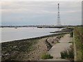
Former Paper Mills Wharf
A jetty at this point was removed 2005-2006 as a new residential development replaced the industrial works here before.
Image: © Oast House Archive
Taken: 12 Aug 2011
0.09 miles
8

The Thames at Greenhithe
The riverside at Greenhithe is a pleasant place to be in summer with views upriver to the Queen Elizabeth II Bridge and downriver to Swanscombe and West Thurrock. The adjacent development at Ingress Park makes it a popular promenade. In the distance is the 623 feet high pylon at Swanscombe - see http://www.geograph.org.uk/photo/1669490.
Image: © Marathon
Taken: 1 Aug 2011
0.10 miles
9

Ingress Park, Greenhithe
The riverside at Greenhithe is a pleasant place to be in summer with views upriver to the Queen Elizabeth II Bridge and downriver to Swanscombe and West Thurrock. The adjacent development at Ingress Park makes it a popular promenade. In the distance is the 623 feet high pylon at Swanscombe - see http://www.geograph.org.uk/photo/1669490.
Image: © Marathon
Taken: 1 Aug 2011
0.10 miles
10

Shoreline view to riverside apartments, Greenhithe
Image: © David Martin
Taken: 4 Jul 2021
0.11 miles