
IMAGES TAKEN NEAR TO
Cotton Lane, GREENHITHE, DA9 9BB
Introduction
This page details the photographs taken nearby to Cotton Lane, DA9 9BB by members of the Geograph project.
The Geograph project started in 2005 with the aim of publishing, organising and preserving representative images for every square kilometre of Great Britain, Ireland and the Isle of Man.

There are currently over 7.5m images from over14,400 individuals and you can help contribute to the project by visiting https://www.geograph.org.uk
Image Map
Images are licensed for reuse under creativecommons.org/licenses/by-sa/2.0
Notes
- Clicking on the map will re-center to the selected point.
- The higher the marker number, the further away the image location is from the centre of the postcode.
Image Listing (19 Images Found)
Images are licensed for reuse under creativecommons.org/licenses/by-sa/2.0
Image
Details
Distance
1
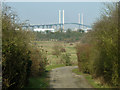
View towards the Queen Elizabeth II bridge
A track serving the Stone power plant of Viridor Waste Management, here also a public footpath. Much of the terrain around here is landfill in old chalk quarries, with presumably sufficient methane production to justify a very small power station.
Image: © Robin Webster
Taken: 1 Mar 2012
0.07 miles
2
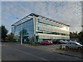
Mariner House, Moat Housing
Headquarters building within the Crossways Business Park.
On Galleon Boulevard.
Image: © David Anstiss
Taken: 9 Dec 2021
0.11 miles

4
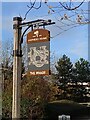
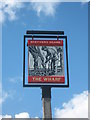
The Wharf pub sign
Shepherd Neame run pub sign beside Galleons Boulevard in the Crossways Business Park.
Image: © David Anstiss
Taken: 9 Dec 2021
0.13 miles
5
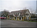
The Wharf Pub, Cotton Lake, Dartford
Cotton Lake, Galleon Boulevard, Dartford, DA2 6QE close to the River Thames Tideway
Image: © canalandriversidepubs co uk
Taken: 7 Feb 2010
0.13 miles
7
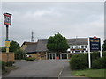
The Wharf Public House, Dartford
On Galleon Boulevard in Crossways Business Park.
Image: © David Anstiss
Taken: 12 May 2009
0.14 miles
8
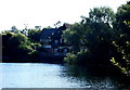
Dartford, Crossways Business Pk - DA2
"The Wharf" pub, as seen from a small fishing jetty some several hundred metres away from it. The business park location is adjacent to the Dartford Bridge and the pub clientele often includes guests that are staying at the nearby Hilton Hotel - 10 mins walk away.
Image: © David Hallam-Jones
Taken: 10 Aug 2012
0.14 miles
9
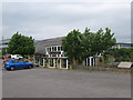
The Wharf Public House on Cotton Lake
This pub on Galleon Boulevard overlooks Cotton Lake (on right) in Crossways Business Park in Dartford.
Image: © David Anstiss
Taken: 12 May 2009
0.16 miles
10
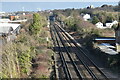
Railway tracks east towards Stone Crossing
The station platforms can just be seen in the distance.
Image: © David Martin
Taken: 25 Feb 2023
0.19 miles