IMAGES TAKEN NEAR TO
Turners Place, East Hill, DARTFORD, DA4 9BF
Introduction
This page details the photographs taken nearby to Turners Place, East Hill, DA4 9BF by members of the Geograph project.
The Geograph project started in 2005 with the aim of publishing, organising and preserving representative images for every square kilometre of Great Britain, Ireland and the Isle of Man.

There are currently over 7.5m images from over14,400 individuals and you can help contribute to the project by visiting https://www.geograph.org.uk
Image Map
Images are licensed for reuse under creativecommons.org/licenses/by-sa/2.0
Notes
- Clicking on the map will re-center to the selected point.
- The higher the marker number, the further away the image location is from the centre of the postcode.
Image Listing (103 Images Found)
Images are licensed for reuse under creativecommons.org/licenses/by-sa/2.0
Image
Details
Distance
1

South Darenth
This seems to be the village centre. Taken looking up East Hill from its junction with Holmesdale Road.
Image: © David Kemp
Taken: 2 Jul 2016
0.01 miles


4
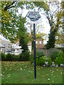
Village sign at South Darenth
The South Darenth village sign features the River Darent, St Mary's Church at Horton Kirby, Horton Kirby Viaduct and the chimney of the former Horton Kirby Paper Mill - see http://www.geograph.org.uk/photo/3137525 , http://www.geograph.org.uk/photo/3131566 , http://www.geograph.org.uk/photo/3137478 , and http://www.geograph.org.uk/photo/3137450
Although they are separated, Horton Kirby and South Darenth seem to be regarded as the same village. They even have the same village sign - see http://www.geograph.org.uk/photo/3137603 Two of the features (the viaduct and the chimney) are actually in South Darenth, the church is in Horton Kirby while the River Darent is common to both, although less of a feature in Horton Kirby than in South Darenth.
Image: © Marathon
Taken: 25 Oct 2012
0.02 miles

6

The Jolly Millers, South Darenth
On the corner of East Hill and Holmesdale Road.
Image: © pam fray
Taken: 20 Jan 2020
0.02 miles
7

South Darenth village sign
The South Darenth village sign features the River Darent, St Mary's Church at Horton Kirby, Horton Kirby Viaduct and the chimney of the former Horton Kirby Paper Mill - see http://www.geograph.org.uk/photo/3137525 , http://www.geograph.org.uk/photo/3131566 , http://www.geograph.org.uk/photo/3137478 , and http://www.geograph.org.uk/photo/3137450
Although they are separated, Horton Kirby and South Darenth seem to be regarded as the same village. They even have the same village sign - see http://www.geograph.org.uk/photo/3137603 Two of the features (the viaduct and the chimney) are actually in South Darenth, the church is in Horton Kirby while the River Darent is common to both, although less of a feature in Horton Kirby than in South Darenth.
Image: © Marathon
Taken: 25 Oct 2012
0.02 miles
8

Pharmacy and Post Office on Holmesdale Road, South Darenth
Image: © JThomas
Taken: 24 Jun 2022
0.02 miles
9
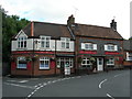
The Jolly Millers Pub, South Darenth
It looks as though it has been extended at some point -- note the two different building styles.
Image: © Danny P Robinson
Taken: 10 Aug 2008
0.02 miles