
IMAGES TAKEN NEAR TO
Water Mill Way, DARTFORD, DA4 9BB
Introduction
This page details the photographs taken nearby to Water Mill Way, DA4 9BB by members of the Geograph project.
The Geograph project started in 2005 with the aim of publishing, organising and preserving representative images for every square kilometre of Great Britain, Ireland and the Isle of Man.

There are currently over 7.5m images from over14,400 individuals and you can help contribute to the project by visiting https://www.geograph.org.uk
Image Map
Images are licensed for reuse under creativecommons.org/licenses/by-sa/2.0
Notes
- Clicking on the map will re-center to the selected point.
- The higher the marker number, the further away the image location is from the centre of the postcode.
Image Listing (94 Images Found)
Images are licensed for reuse under creativecommons.org/licenses/by-sa/2.0
Image
Details
Distance

2

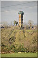
Chimney, South Darenth
This was part of the Horton Kirby paper mill. The mill has now been demolished and housing is being built on the site.
Image: © Danny P Robinson
Taken: 10 Aug 2008
0.14 miles

6

Railway Bridge over Dartford Road
Near Farningham Road station. Viewed from Station Road looking north towards Sutton at Hone.
Image: © pam fray
Taken: 20 Jan 2020
0.15 miles

9

NIMBY graffiti on railway bridge over A225 road near Farningham Road station, 1989
View northward on A225 (Farningham - Dartford) road under the ex-SE&CR London Victoria (to left) - (to right) Chatham - Ramsgate/Dover main line, just east of Farningham Road station. This was after the Channel Tunnel Rail Link was first mooted and as it turned out the Eurostar trains ran past here until in 2007 they ceased to run to and from Waterloo International.
Image: © Ben Brooksbank
Taken: 4 Jun 1989
0.17 miles
10

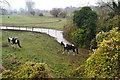
The River Darent running through housing at the former Horton Kirby Paper Mill
Horton Kirby Paper Mill was built in the 1820s, with the majority of the buildings extended during the 1870s and 1880s. It closed as a working mill at the end of 2003. It had two chimneys. The taller of the two mill chimneys was constructed in 1881 indicating a major expansion at that time. It was extended by 70 feet to 225 feet in 1918 and has been a major feature of this part of the Darent Valley ever since. The whole complex has now been redeveloped as an attractive housing development with the River Darent running through it, as seen here. The larger of the two chimneys has been kept, but reduced back to its original height - see http://www.geograph.org.uk/photo/3137450
Image: © Marathon
Taken: 17 Sep 2012
0.17 miles