IMAGES TAKEN NEAR TO
Hartley Hill, LONGFIELD, DA3 8LL
Introduction
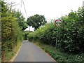
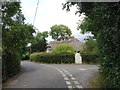
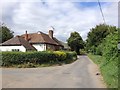
This page details the photographs taken nearby to Hartley Hill, DA3 8LL by members of the Geograph project.
The Geograph project started in 2005 with the aim of publishing, organising and preserving representative images for every square kilometre of Great Britain, Ireland and the Isle of Man.

There are currently over 7.5m images from over14,400 individuals and you can help contribute to the project by visiting https://www.geograph.org.uk
Image Map (5 Images)


Getting Data...Please wait
Leaflet Map data © OpenStreetMap
Images are licensed for reuse under creativecommons.org/licenses/by-sa/2.0
Notes
- Clicking on the map will re-center to the selected point.
- The higher the marker number, the further away the image location is from the centre of the postcode.
Image Listing (5 Images Found)
Images are licensed for reuse under creativecommons.org/licenses/by-sa/2.0
Image
Details
Distance
4
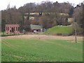
Hartley Pumping Station
On access road of Hartley Bottom Road. Seen from footpath from Hartley Bottom Road to Grange Lane.
Image: © David Anstiss
Taken: 23 Mar 2009
0.22 miles
5
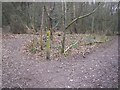
Footpath Junction in Nine Horse Wood
Path from Hartley Hill goes through wood to this junction then splits, one path goes left to Lambardes road, the other (on right) goes to Northash Road.
Image: © David Anstiss
Taken: 20 Feb 2009
0.24 miles