IMAGES TAKEN NEAR TO
Ayelands, LONGFIELD, DA3 8JU
Introduction
This page details the photographs taken nearby to Ayelands, DA3 8JU by members of the Geograph project.
The Geograph project started in 2005 with the aim of publishing, organising and preserving representative images for every square kilometre of Great Britain, Ireland and the Isle of Man.

There are currently over 7.5m images from over14,400 individuals and you can help contribute to the project by visiting https://www.geograph.org.uk
Image Map
Images are licensed for reuse under creativecommons.org/licenses/by-sa/2.0
Notes
- Clicking on the map will re-center to the selected point.
- The higher the marker number, the further away the image location is from the centre of the postcode.
Image Listing (17 Images Found)
Images are licensed for reuse under creativecommons.org/licenses/by-sa/2.0
Image
Details
Distance
2
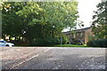
Chapel Wood, New Ash Green
New Ash Green was designed by Eric Lyons in the 1960s as a new village on a greenfield site and its construction was started by Span. After the failure of the original builder, the majority was completed by Bovis. Chapel Wood is typical of the Bovis-built neighbourhoods and here, in the far north-west corner of New Ash Green, it is easy to see how the extensive landscaping within the residential development links to the woods and countryside beyond, to the left.
Image: © Cameron Clark
Taken: 29 Dec 2008
0.12 miles
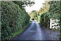
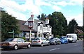
5
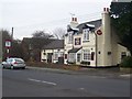
The Royal Oak Pub, New Ash Green
On Chapel Wood Road.
Image: © David Anstiss
Taken: 20 Feb 2009
0.16 miles

7
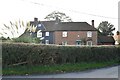
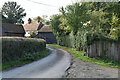
Johnson's Farmhouse
Grade II listed. https://historicengland.org.uk/listing/the-list/list-entry/1235103
Image: © N Chadwick
Taken: 22 Oct 2019
0.17 miles
8
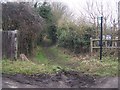
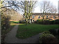
Footpath on Butchers Lane
Leads through Redlibbets Golf Course to Manor Lane. On right is carpark for 'Go Bananas', a children's activity centre.
Image: © David Anstiss
Taken: 20 Feb 2009
0.17 miles
9
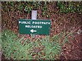
Spot the spelling mistake !!
On sign showing the diversion in a footpath from The Mead to Chapel Wood Road, near the Pub.
Image: © David Anstiss
Taken: 23 Mar 2009
0.18 miles