
IMAGES TAKEN NEAR TO
Main Road, LONGFIELD, DA3 7AG
Introduction
This page details the photographs taken nearby to Main Road, DA3 7AG by members of the Geograph project.
The Geograph project started in 2005 with the aim of publishing, organising and preserving representative images for every square kilometre of Great Britain, Ireland and the Isle of Man.

There are currently over 7.5m images from over14,400 individuals and you can help contribute to the project by visiting https://www.geograph.org.uk
Image Map
Images are licensed for reuse under creativecommons.org/licenses/by-sa/2.0
Notes
- Clicking on the map will re-center to the selected point.
- The higher the marker number, the further away the image location is from the centre of the postcode.
Image Listing (33 Images Found)
Images are licensed for reuse under creativecommons.org/licenses/by-sa/2.0
Image
Details
Distance
1
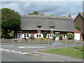
Cottages at Longfield Hill
At the corner of Main Road and Nurstead Lane.
Image: © Danny P Robinson
Taken: 10 Aug 2008
0.04 miles
2
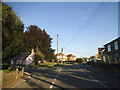
Main Road at the junction of Nurstead Lane
Image: © David Howard
Taken: 6 Sep 2015
0.04 miles
4
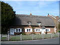
Ivydew Cottage at Longfield Hill
The small green at Longfield Hill is an attractive feature with its Mission Church. This view looks from the green to two of the surrounding cottages.
Image: © Marathon
Taken: 10 Mar 2012
0.05 miles

6
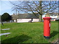
The village green at Longfield Hill and the Mission Church
The pretty little green at Longfield Hill is enhanced by the Mission Church which is on the green. The Mission Church at Longfield Hill was originally Longfield School, built in the late 19th century. When the ‘new school’ was built in Longfield (now sold) the Longfield Hill building was sold for a private dwelling for the sum of £30. Subsequently it was bought back by the church for the sum of £40 to be used as a place of worship.
Image: © Marathon
Taken: 10 Mar 2012
0.06 miles
7
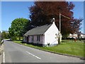
Disused mission church at Longfield Hill
At first sight I thought that this little building - now in a forlorn state - might be the disused parish hall. I then spotted the belfry at the southern end, and wondered whether it had been used as a chapel.
Earlier contributors identify it as Longfield Hill Mission Church. At the time of Chris Whippet's visit in 2015 it was disused and up for sale: https://www.geograph.org.uk/photo/4552716 According to Marathon https://www.geograph.org.uk/photo/2842161 it was originally built as a school - so (it occurs to me) the bell may date from that time, rather from subsequent use as a chapel.
I'm left wondering - how did the need for a 'mission' church come about? The railway (the Gravesend West Street branch) reached the area in 1886, so perhaps (as I've noted elsewhere https://www.geograph.org.uk/photo/2181176) the mission's purpose was to 'save' the railway navvies.
Image: © Stefan Czapski
Taken: 6 May 2018
0.06 miles
9
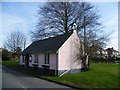
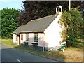
Longfield Hill Mission Church
The pretty little green at Longfield Hill is enhanced by the Mission Church which is on the green. The Mission Church at Longfield Hill was originally Longfield School, built in the late 19th century. When the ‘new school’ was built in Longfield (now sold) the Longfield Hill building was sold for a private dwelling for the sum of £30. Subsequently it was bought back by the church for the sum of £40 to be used as a place of worship.
Image: © Marathon
Taken: 10 Mar 2012
0.06 miles
10
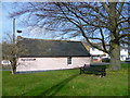
Longfield Hill Mission Church
The pretty little green at Longfield Hill is enhanced by the Mission Church which is on the green. The Mission Church at Longfield Hill was originally Longfield School, built in the late 19th century. When the ‘new school’ was built in Longfield (now sold) the Longfield Hill building was sold for a private dwelling for the sum of £30. Subsequently it was bought back by the church for the sum of £40 to be used as a place of worship.
Image: © Marathon
Taken: 10 Mar 2012
0.06 miles