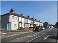
IMAGES TAKEN NEAR TO
Sinclair Way, DARTFORD, DA2 7JS
Introduction
This page details the photographs taken nearby to Sinclair Way, DA2 7JS by members of the Geograph project.
The Geograph project started in 2005 with the aim of publishing, organising and preserving representative images for every square kilometre of Great Britain, Ireland and the Isle of Man.

There are currently over 7.5m images from over14,400 individuals and you can help contribute to the project by visiting https://www.geograph.org.uk
Image Map
Images are licensed for reuse under creativecommons.org/licenses/by-sa/2.0
Notes
- Clicking on the map will re-center to the selected point.
- The higher the marker number, the further away the image location is from the centre of the postcode.
Image Listing (29 Images Found)
Images are licensed for reuse under creativecommons.org/licenses/by-sa/2.0
Image
Details
Distance
1
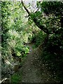
Footpath Through Darenth Wood
This path passes through Darenth wood, there are various notices at the A296 end of the path about the dire consequences should one stray from the right of way into private woodland. The view here is from the Darenth end looking approximately northeast
Image: © Glyn Baker
Taken: 4 Sep 2005
0.09 miles
2
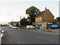
Watchgate, Darenth, near Dartford
Watchgate forms part of the route of the B260 road as it passes through the village of Dareth. A Co-op local convenience store stands in the opposite side of the road.
Image: © Malc McDonald
Taken: 3 Oct 2021
0.09 miles
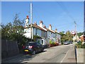
4
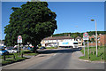
Lorry on Mini-Roundabout
Articulated lorry, at junction of Green Street Green Road and Darenth Hill.
Image: © Oast House Archive
Taken: 16 Jun 2010
0.09 miles
5
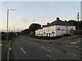
Green Street, Darenth
Green Street, heading out of the north Kent village of Darenth, forms part of the route of the B260 road.
This image was taken at dusk on an October evening, as the daylight was fading.
Image: © Malc McDonald
Taken: 3 Oct 2021
0.11 miles
6
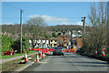
Road works at Lane End
At the junction of Darenth Hill with B260 Green Street Green Road.
Image: © Robin Webster
Taken: 8 Mar 2012
0.11 miles
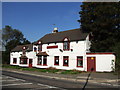
8
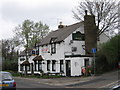
The Fox and Hounds Public House, Lane End
On junction of B260 Green Street Green Road (on left) and Wood Lane (on right).
Image: © David Anstiss
Taken: 9 Apr 2009
0.11 miles
9
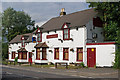
The Fox and Hounds
Situated at the north end of Darenth village, the pub appears to be closed, but without any of the sign of decay that often seems to accompany closure. So please correct me if I'm wrong.
Image: © Ian Capper
Taken: 11 May 2011
0.11 miles