
IMAGES TAKEN NEAR TO
Riverside Wharf, DARTFORD, DA1 5TR
Introduction
This page details the photographs taken nearby to Riverside Wharf, DA1 5TR by members of the Geograph project.
The Geograph project started in 2005 with the aim of publishing, organising and preserving representative images for every square kilometre of Great Britain, Ireland and the Isle of Man.

There are currently over 7.5m images from over14,400 individuals and you can help contribute to the project by visiting https://www.geograph.org.uk
Image Map
Images are licensed for reuse under creativecommons.org/licenses/by-sa/2.0
Notes
- Clicking on the map will re-center to the selected point.
- The higher the marker number, the further away the image location is from the centre of the postcode.
Image Listing (30 Images Found)
Images are licensed for reuse under creativecommons.org/licenses/by-sa/2.0
Image
Details
Distance
1
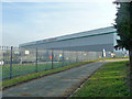
New depot
Apparently a speculative build, later it became an Asda depot.
Image: © Robin Webster
Taken: 1 Mar 2012
0.07 miles
2
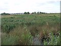
Dartford Freshwater Marshes
The Dartford Freshwater Marshes contains some of the wettest and ecologically most valuable parts of the surviving Dartford Marshes. Here the SW corner of the marsh alongside the embankment of the tidal River Darent contains extensive areas of permanent standing water. These wetland areas include a substantial reedbed (Phragmites australis), or stands of tall emergent vegetation such as reedmace (Typha latifolia), sedges (Carex spp), rushes (Juncus), burr reed (Sparganium erectum) or canary grass (Phalaris arundinacea).
Image: © David Leeming
Taken: 12 May 2011
0.08 miles
3
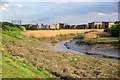
The Edge of Dartford
Looking upstream on The River Darent
Image: © Glyn Baker
Taken: 22 Apr 2017
0.08 miles
4
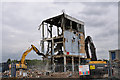
Arjo Wiggins - Paper Mill demolished - August 2010
See Geograph photograph Image
Image: © Brian Chadwick
Taken: 12 Aug 2010
0.10 miles
5

Arjo Wiggins - Dartford Paper Mill -
Due to be demolished to make way for development to the north of Dartford.
See Image] by Nigel Cox
Image: © Brian Chadwick
Taken: 6 Apr 2010
0.11 miles
6

Dartford Fresh Marshes
This would be an inaccessible area were it not for a public path that follows the top of Dartford Creek's flood embankment. From here the view is of a sea of reeds with the chimney of Littlebrook Power Station in the distance.
Image: © Stephen McKay
Taken: 19 Mar 2012
0.11 miles
10
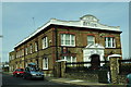
Mill House Offices
The former offices of the Dartford Paper Mill - built a century ago ( 1910 )
Image: © Brian Chadwick
Taken: 6 Apr 2010
0.14 miles