
IMAGES TAKEN NEAR TO
Dorney Place, DARTFORD, DA1 5RT
Introduction
This page details the photographs taken nearby to Dorney Place, DA1 5RT by members of the Geograph project.
The Geograph project started in 2005 with the aim of publishing, organising and preserving representative images for every square kilometre of Great Britain, Ireland and the Isle of Man.

There are currently over 7.5m images from over14,400 individuals and you can help contribute to the project by visiting https://www.geograph.org.uk
Image Map
Images are licensed for reuse under creativecommons.org/licenses/by-sa/2.0
Notes
- Clicking on the map will re-center to the selected point.
- The higher the marker number, the further away the image location is from the centre of the postcode.
Image Listing (23 Images Found)
Images are licensed for reuse under creativecommons.org/licenses/by-sa/2.0
Image
Details
Distance
1
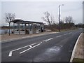
Fast track bus station beside Littlebrook Lake
The fast track links The Bridge ( a new development on the former site of Joyce Green hospital) with Dartford and Greenhithe. The Queen Elizabeth 2 bridge is in the background. The stop is near Marsh Street and a new housing complex.
Image: © David Anstiss
Taken: 15 Feb 2009
0.01 miles
2
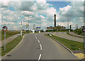
Marsh Street
Access to industrial development off the A206. Littlebrook Power Station Image in the background.
Image: © Alan Murray-Rust
Taken: 26 Apr 2009
0.03 miles
3
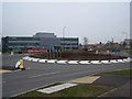
The Nucleus or Marsh Street roundabout
The Nucleus is a business and inovation centre. It is part of The Bridge, a development site of the former site of Joyce Green Hospital. This building offers flexible office space for science and technology companies. It is operated by Start (for more details see http://www.start-anywhere.com).
The houses in the background are the first phase of houses on the land.
Marsh Street leads left to meet the A206 University Way - dual carriageway.
Image: © David Anstiss
Taken: 15 Feb 2009
0.05 miles
4
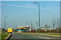
Bus stop where dedicated busway crosses Marsh Street North
The larger building is some sort of office for 'The Bridge' development.
Image: © Robin Webster
Taken: 1 Mar 2012
0.07 miles
5
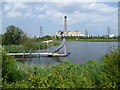
Mermaid at Littlebrook Nature Park
The Bridge is a new development just upriver of the Queen Elizabeth II Bridge near Dartford. Included as part of the development is Littlebrook Nature Park where there are two reclaimed lakes. This sculpture of a mermaid seems to be fairly recent. In the background is the chimney of the Littlebrook D Power Station which at 705 feet is the 4th tallest in the United Kingdom. On the extreme right is the Queen Elizabeth II Bridge at Dartford.
Image: © Marathon
Taken: 1 Aug 2011
0.07 miles
6
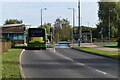
Fastrack bus route at junction with Marsh Street North
For details see https://www.go-fastrack.co.uk/
Image: © David Martin
Taken: 7 Nov 2021
0.09 miles
7
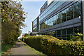
Byway passing office building at The Bridge
Image: © David Martin
Taken: 7 Nov 2021
0.10 miles
9
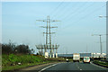
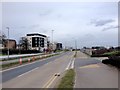
Power lines by A206
Overhead goes underground.
Image: © Robin Webster
Taken: 1 Mar 2012
0.12 miles
10
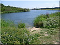
Lake at Littlebrook Nature Park
The Bridge is a new development just upriver of the Queen Elizabeth II Bridge near Dartford. Included as part of the development is Littlebrook Nature Park where there are two reclaimed lakes. This is the southern lake. The building in the distance is the Holiday Inn Express, Dartford Bridge.
Image: © Marathon
Taken: 1 Aug 2011
0.12 miles