
IMAGES TAKEN NEAR TO
McCudden Road, DARTFORD, DA1 5QL
Introduction
This page details the photographs taken nearby to McCudden Road, DA1 5QL by members of the Geograph project.
The Geograph project started in 2005 with the aim of publishing, organising and preserving representative images for every square kilometre of Great Britain, Ireland and the Isle of Man.

There are currently over 7.5m images from over14,400 individuals and you can help contribute to the project by visiting https://www.geograph.org.uk
Image Map
Images are licensed for reuse under creativecommons.org/licenses/by-sa/2.0
Notes
- Clicking on the map will re-center to the selected point.
- The higher the marker number, the further away the image location is from the centre of the postcode.
Image Listing (40 Images Found)
Images are licensed for reuse under creativecommons.org/licenses/by-sa/2.0
Image
Details
Distance
2

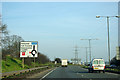
Dartford: A206 Bob Dunn Way
This road was formerly University Way and before that the Dartford Northern Bypass. It was opened in 1994 and became University Way in the expectation that the University of Greenwich would build a new campus to the north. In the event they did not, and the road was renamed in 2004 in memory of the local MP, Bob Dunn (1946-2003), who had long campaigned for a bypass around the town. The QEII bridge is just visible in the distance.
Image: © Nigel Cox
Taken: 2 Mar 2008
0.05 miles
3

Bridleway bridge over A206
Formerly the only easy way of crossing the dual carriageway, there is now a new road bridge further west.
Image: © Robin Webster
Taken: 1 Mar 2012
0.07 miles
4

Footbridge over A206 University Way
This footbridge leads over the busy dual carriageway, it used to lead to Joyce Green Hospital. But that has been demolished and a new housing development
(The Bridge) and new college is currently being built on this site. The bus on the left links Temple Hill with Dartford.
Image: © David Anstiss
Taken: 15 Feb 2009
0.08 miles
5
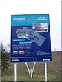
Sign about The Bridge
On former hospital site of Joyce Green. For more details see http://www.thebridgedartford.co.uk
Image: © David Anstiss
Taken: 15 Feb 2009
0.11 miles
8
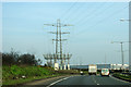
Power lines by A206
Overhead goes underground.
Image: © Robin Webster
Taken: 1 Mar 2012
0.12 miles
10
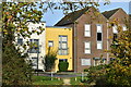
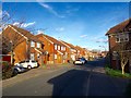
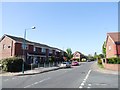
Houses in Brunel Way, seen from footpath
Image: © David Martin
Taken: 7 Nov 2021
0.13 miles