
IMAGES TAKEN NEAR TO
Dunlop Close, DARTFORD, DA1 5LU
Introduction
This page details the photographs taken nearby to Dunlop Close, DA1 5LU by members of the Geograph project.
The Geograph project started in 2005 with the aim of publishing, organising and preserving representative images for every square kilometre of Great Britain, Ireland and the Isle of Man.

There are currently over 7.5m images from over14,400 individuals and you can help contribute to the project by visiting https://www.geograph.org.uk
Image Map
Images are licensed for reuse under creativecommons.org/licenses/by-sa/2.0
Notes
- Clicking on the map will re-center to the selected point.
- The higher the marker number, the further away the image location is from the centre of the postcode.
Image Listing (38 Images Found)
Images are licensed for reuse under creativecommons.org/licenses/by-sa/2.0
Image
Details
Distance
1

Entrance to Fastrack dedicated bus route
For details see https://www.go-fastrack.co.uk/
Image: © David Martin
Taken: 7 Nov 2021
0.03 miles

3

Dartford: Fastrack busway
The Fastrack bus service will eventually provide a network of express bus routes in Kent Thameside, in several cases following new dedicated roads. This is the Busway at the western end of The Bridge development that allows Fastrack buses on Route 'A', and no other vehicles, to pass under the QEII bridge approach to rejoin the public road system on the A206 Crossways Boulevard. The Fastrack website is here http://www.go-fastrack.co.uk/default.asp The blue coloured surface at the entrance to the busway is designed to emphasise that the road is dedicated to buses only. Here the busway leaves Joyce Green Lane and goes up over a new bridge over the A206 Bob Dunn Way.
Image: © Nigel Cox
Taken: 2 Mar 2008
0.04 miles
5

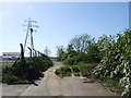
New buses only bridge over A206
Also for cycles and foot.
Image: © Robin Webster
Taken: 1 Mar 2012
0.06 miles


9

Joyce Green Lane, Dartford: traffic-free section
This is the section of the lane immediately south of where it meets the bypass Image It is now merely a bridleway. Eventually the tarmac will no doubt disappear and it will turn into a narrow path.
Image: © Stephen Craven
Taken: 20 Feb 2011
0.09 miles
10

Dartford: A206 Bob Dunn Way
This road was formerly University Way and before that the Dartford Northern Bypass. It was opened in 1994 and became University Way in the expectation that the University of Greenwich would build a new campus to the north. In the event they did not, and the road was renamed in 2004 in memory of the local MP, Bob Dunn (1946-2003), who had long campaigned for a bypass around the town. The bridge in the distance is the new Fastrack link bridge between the Bluewater shopping centre and Dartford town centre.
Image: © Nigel Cox
Taken: 2 Mar 2008
0.09 miles