
IMAGES TAKEN NEAR TO
Dale Close, DARTFORD, DA1 3PP
Introduction
This page details the photographs taken nearby to Dale Close, DA1 3PP by members of the Geograph project.
The Geograph project started in 2005 with the aim of publishing, organising and preserving representative images for every square kilometre of Great Britain, Ireland and the Isle of Man.

There are currently over 7.5m images from over14,400 individuals and you can help contribute to the project by visiting https://www.geograph.org.uk
Image Map
Images are licensed for reuse under creativecommons.org/licenses/by-sa/2.0
Notes
- Clicking on the map will re-center to the selected point.
- The higher the marker number, the further away the image location is from the centre of the postcode.
Image Listing (35 Images Found)
Images are licensed for reuse under creativecommons.org/licenses/by-sa/2.0
Image
Details
Distance
1
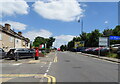
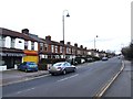
Crayford Road
Showing position of Postbox No. DA1 180.
Junction with Ducketts Road.
See Image] for postbox.
Image: © JThomas
Taken: 20 Jun 2022
0.06 miles
2
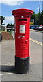
George V postbox on Crayford Road
Postbox No. DA1 180.
See Image] for context.
Image: © JThomas
Taken: 20 Jun 2022
0.06 miles
6
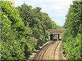
Railway at Crayford
Railway tracks at Crayford, on the outermost fringe of south east London. The railway is electrified using the third rail system.
Visible in the distance is the Queen Elizabeth II Bridge linking Kent with Essex.
Image: © Malc McDonald
Taken: 14 Jul 2019
0.10 miles
7
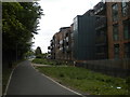
Station Approach, Crayford
The section of Station Approach from Station Road (behind the photographer) to the station has been pedestrianised, and now has low rise blocks of flats on its north side (right).
Image: © Richard Vince
Taken: 14 May 2016
0.13 miles
8
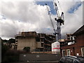
Development site in Crayford
A block of under-developed land between Crayford Library (building on the right),Crayford Town Hall on Crayford Road, and the railway line is being built on.
Presumably a block of apartments for central London commuters.
Image: © David Anstiss
Taken: 14 Aug 2011
0.14 miles
9
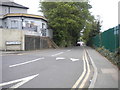
Top of Lower Station Road, Crayford
The road to the railway station from Station Road.
Image: © Richard Vince
Taken: 14 May 2016
0.14 miles
10
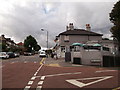
The Charlotte, Public House, Crayford
On the junction of Station Road (on the left) and Lower Station Road (on the right - heading towards Crayford Station).
Image: © David Anstiss
Taken: 14 Aug 2011
0.14 miles