
IMAGES TAKEN NEAR TO
Hampton Crescent, GRAVESEND, DA12 4HZ
Introduction
This page details the photographs taken nearby to Hampton Crescent, DA12 4HZ by members of the Geograph project.
The Geograph project started in 2005 with the aim of publishing, organising and preserving representative images for every square kilometre of Great Britain, Ireland and the Isle of Man.

There are currently over 7.5m images from over14,400 individuals and you can help contribute to the project by visiting https://www.geograph.org.uk
Image Map
Images are licensed for reuse under creativecommons.org/licenses/by-sa/2.0
Notes
- Clicking on the map will re-center to the selected point.
- The higher the marker number, the further away the image location is from the centre of the postcode.
Image Listing (14 Images Found)
Images are licensed for reuse under creativecommons.org/licenses/by-sa/2.0
Image
Details
Distance
2
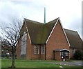
St Aidan's Church Gravesend
A modern Church in a mainly 1950's housing estate
Image: © Glyn Baker
Taken: 2 Apr 2006
0.13 miles
3
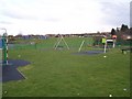
Westcourt Recreational Ground
On St Gregory's Crescent. This large open area on top of a hill, has many uses, kids playground in foreground, football courts in background on left and general dogwalking and other use the rest of the ground.
Image: © David Anstiss
Taken: 28 Mar 2009
0.13 miles
6
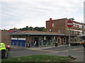
Tesco Metro, The Parade, Gravesend
Mini supermarket on Valley Drive, at the end of the Parade (row of smaller shops), close to Thomas Drive.
Image: © David Anstiss
Taken: 25 Aug 2010
0.18 miles
9
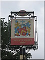
The Westcourt Inn, Pub Sign, Gravesend
Outside the front of Image
Image: © David Anstiss
Taken: 25 Aug 2010
0.22 miles
10
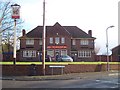
Westcourt Inn Public House, Gravesend
On junction of St Dunstan's Drive (on right) and St Hilda's Way (on left).
Image: © David Anstiss
Taken: 28 Mar 2009
0.23 miles