
IMAGES TAKEN NEAR TO
Cobham, GRAVESEND, DA12 3BL
Introduction
This page details the photographs taken nearby to DA12 3BL by members of the Geograph project.
The Geograph project started in 2005 with the aim of publishing, organising and preserving representative images for every square kilometre of Great Britain, Ireland and the Isle of Man.

There are currently over 7.5m images from over14,400 individuals and you can help contribute to the project by visiting https://www.geograph.org.uk
Image Map
Images are licensed for reuse under creativecommons.org/licenses/by-sa/2.0
Notes
- Clicking on the map will re-center to the selected point.
- The higher the marker number, the further away the image location is from the centre of the postcode.
Image Listing (6 Images Found)
Images are licensed for reuse under creativecommons.org/licenses/by-sa/2.0
Image
Details
Distance

2

Scottish country dancing at Cobham Hall in 1980
The venue was hosted by the Gravesend and Meopham group and took place in the evening. I attended as a participant from the Ashford (Kent) group. There had been heavy showers of rain during the morning which meant that the grass was very wet so that some of us forsook our Highland pumps in favour of ordinary shoes. There had been a period of sunshine during the afternoon; however by evening the sky had clouded over but it remained dry. The wind that had been gusty during the day had calmed down by the evening.
Image: © John Baker
Taken: 19 Jul 1980
0.05 miles
3
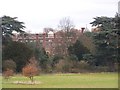
Cobham Hall School
From footpath in Rochester and Cobham Golf Course, heading to Shorne from Cobham Village.
Image: © David Anstiss
Taken: 20 Nov 2008
0.15 miles


