IMAGES TAKEN NEAR TO
Bow Arrow Lane, DARTFORD, DA1 1YY
Introduction
This page details the photographs taken nearby to Bow Arrow Lane, DA1 1YY by members of the Geograph project.
The Geograph project started in 2005 with the aim of publishing, organising and preserving representative images for every square kilometre of Great Britain, Ireland and the Isle of Man.

There are currently over 7.5m images from over14,400 individuals and you can help contribute to the project by visiting https://www.geograph.org.uk
Image Map
Images are licensed for reuse under creativecommons.org/licenses/by-sa/2.0
Notes
- Clicking on the map will re-center to the selected point.
- The higher the marker number, the further away the image location is from the centre of the postcode.
Image Listing (40 Images Found)
Images are licensed for reuse under creativecommons.org/licenses/by-sa/2.0
Image
Details
Distance
3
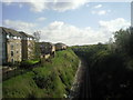
Railway cutting seen from St Vincents Road
This view looks away from Dartford towards the M25 which is just beyond the curve.
Image: © Marathon
Taken: 12 Apr 2011
0.05 miles
4
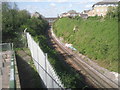
View up the railway line towards Dartford
Seen from the footbridge connecting the two halves of Bow Arrow Lane which crosses the Dartford Tunnel Approach, there is a good view along the cutting through the chalk which takes the line towards Dartford. The bridge in the distance carries St Vincents Avenue over the railway and just beyond that are Dartford Carriage Sidings.
Image: © Marathon
Taken: 12 Apr 2011
0.05 miles
6
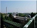
How Many Bridges?
This is a photo of the Dartford Tunnel approach road the A282. Contrary to popular belief the M25 does not encircle London entirely it is a broken circle. The approaches and crossings themselves are not motorways. How many bridges can you count including the footbridge over the A284 from where the picture was taken?
Image: © Glyn Baker
Taken: 4 Sep 2005
0.06 miles
7
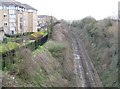
Dartford: Railway line from the St Vincents Road bridge (2)
The railway between Dartford and Stone runs in a very deep cutting here where St Vincents Road crosses the line. See Image for the view in the opposite direction.
Image: © Nigel Cox
Taken: 2 Mar 2008
0.06 miles