IMAGES TAKEN NEAR TO
College Road, GRAVESEND, DA11 9DJ
Introduction
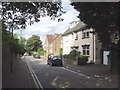
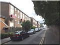
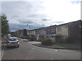
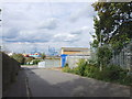
This page details the photographs taken nearby to College Road, DA11 9DJ by members of the Geograph project.
The Geograph project started in 2005 with the aim of publishing, organising and preserving representative images for every square kilometre of Great Britain, Ireland and the Isle of Man.

There are currently over 7.5m images from over14,400 individuals and you can help contribute to the project by visiting https://www.geograph.org.uk
Image Map
Images are licensed for reuse under creativecommons.org/licenses/by-sa/2.0
Notes
- Clicking on the map will re-center to the selected point.
- The higher the marker number, the further away the image location is from the centre of the postcode.
Image Listing (66 Images Found)
Images are licensed for reuse under creativecommons.org/licenses/by-sa/2.0
Image
Details
Distance
1
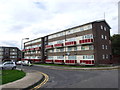
Extension to Ashfield, College Road
Planning permission has been granted by Gravesham Borough Council under application number 20150115 for the “erection of a three storey building providing 9 one bedroom and 1 three bedroom flats, with vehicular access leading to rear car parking and communal amenity garden”.
The extension is to be named Harbour View.
Image: © John Baker
Taken: 13 Nov 2019
0.01 miles