
IMAGES TAKEN NEAR TO
Lower Road, GRAVESEND, DA11 9BB
Introduction
This page details the photographs taken nearby to Lower Road, DA11 9BB by members of the Geograph project.
The Geograph project started in 2005 with the aim of publishing, organising and preserving representative images for every square kilometre of Great Britain, Ireland and the Isle of Man.

There are currently over 7.5m images from over14,400 individuals and you can help contribute to the project by visiting https://www.geograph.org.uk
Image Map
Images are licensed for reuse under creativecommons.org/licenses/by-sa/2.0
Notes
- Clicking on the map will re-center to the selected point.
- The higher the marker number, the further away the image location is from the centre of the postcode.
Image Listing (25 Images Found)
Images are licensed for reuse under creativecommons.org/licenses/by-sa/2.0
Image
Details
Distance
1

Footpath to Swanscombe Marshes
This path leads from Manor Way, Northfleet, past Botany Marshes (on the left) towards Swanscombe Marshes and the River Thames.
Image: © David Anstiss
Taken: 23 Oct 2009
0.05 miles
2
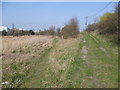
Footpath on the edge of Botany Marshes
The footpath on the left has come from Northfleet and leads across Botany Marshes and Swanscombe Marshes to either Swanscombe or Greenhithe. The grassy track to the right leads up to Manor Way, just beyond the gate.
Image: © Marathon
Taken: 24 Mar 2012
0.05 miles

6

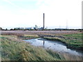
Botany Road, Northfleet
To the left is Britannia Refined Metals.
Image: © Chris Whippet
Taken: 16 Nov 2013
0.10 miles
7

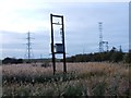
Botany Marshes
Seen from the footpath which leads eventually to Northfleet, Botany Marshes are dominated by industry and pylons. The tallest pylon in the middle is Swanscombe Pylon which at 623 feet is, along with its twin across the Thames at West Thurrock, the highest in the UK and the second highest in Europe. See http://www.geograph.org.uk/photo/1669490 for the view from beneath.
Image: © Marathon
Taken: 24 Mar 2012
0.10 miles
8
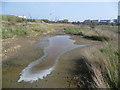
Dried out pond on Botany Marshes
It would seem from its appearance that this pond on Botany Marshes was rather polluted before it dried out. To its left is a path, which turns south in front of the industrial buildings on the right to eventually reach Northfleet. The two blue cranes immediately beyond the former pond are on the other side of the Thames at Tilbury Docks.
Image: © Marathon
Taken: 24 Mar 2012
0.11 miles
10

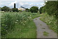
Footpath near Botany Marshes
This path leads from Manor Way, Northfleet past Botany Marshes (on the left) towards Swanscombe Marshes and towards the River Thames. The tall pylon is part of a set carrying cables across the marshes and then across the Thames to Grays, Essex.
Image: © David Anstiss
Taken: 23 Oct 2009
0.12 miles