IMAGES TAKEN NEAR TO
New House Lane, GRAVESEND, DA11 7HJ
Introduction
This page details the photographs taken nearby to New House Lane, DA11 7HJ by members of the Geograph project.
The Geograph project started in 2005 with the aim of publishing, organising and preserving representative images for every square kilometre of Great Britain, Ireland and the Isle of Man.

There are currently over 7.5m images from over14,400 individuals and you can help contribute to the project by visiting https://www.geograph.org.uk
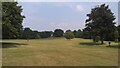
Image Map
Images are licensed for reuse under creativecommons.org/licenses/by-sa/2.0
Notes
- Clicking on the map will re-center to the selected point.
- The higher the marker number, the further away the image location is from the centre of the postcode.
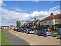
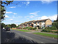
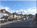
Image Listing (30 Images Found)
Images are licensed for reuse under creativecommons.org/licenses/by-sa/2.0
Image
Details
Distance
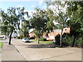
3
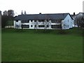
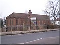
St Georges Gravesend
Just one of the extensive complex of buildings in this C of E School
Image: © Glyn Baker
Taken: 2 Apr 2006
0.09 miles
4
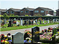
Gravesend cemetery
A part with newer graves where memories have not yet faded.
Image: © Robin Webster
Taken: 27 Jun 2011
0.12 miles
8
The parish Church of St Marys, Gravesend
On Wrotham Road.
Image: © David Anstiss
Taken: 31 Dec 2008
0.15 miles