IMAGES TAKEN NEAR TO
Harden Road, GRAVESEND, DA11 7DS
Introduction
This page details the photographs taken nearby to Harden Road, DA11 7DS by members of the Geograph project.
The Geograph project started in 2005 with the aim of publishing, organising and preserving representative images for every square kilometre of Great Britain, Ireland and the Isle of Man.

There are currently over 7.5m images from over14,400 individuals and you can help contribute to the project by visiting https://www.geograph.org.uk
Image Map
Images are licensed for reuse under creativecommons.org/licenses/by-sa/2.0
Notes
- Clicking on the map will re-center to the selected point.
- The higher the marker number, the further away the image location is from the centre of the postcode.
Image Listing (26 Images Found)
Images are licensed for reuse under creativecommons.org/licenses/by-sa/2.0
Image
Details
Distance
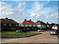
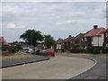
4
Newton Abbot Road, Northfleet
Looking from the Nelson Road end.
Image: © Robin Webster
Taken: 27 Jun 2011
0.11 miles
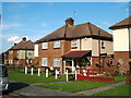
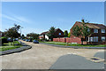
8
Lawrence Square, Gravesend
Off New House Lane.
Small close of small shops and a post office.
Image: © David Anstiss
Taken: 30 Sep 2012
0.15 miles