
IMAGES TAKEN NEAR TO
Manor Way Business Park, Manor Way, SWANSCOMBE, DA10 0PP
Introduction
This page details the photographs taken nearby to Manor Way Business Park, Manor Way, DA10 0PP by members of the Geograph project.
The Geograph project started in 2005 with the aim of publishing, organising and preserving representative images for every square kilometre of Great Britain, Ireland and the Isle of Man.

There are currently over 7.5m images from over14,400 individuals and you can help contribute to the project by visiting https://www.geograph.org.uk
Image Map
Images are licensed for reuse under creativecommons.org/licenses/by-sa/2.0
Notes
- Clicking on the map will re-center to the selected point.
- The higher the marker number, the further away the image location is from the centre of the postcode.
Image Listing (81 Images Found)
Images are licensed for reuse under creativecommons.org/licenses/by-sa/2.0
Image
Details
Distance
1

View from Galley Hill Road, Swanscombe (2)
Showing industrial units on Manor Way, the HS1 high speed rail link, industrial units on Lower Road, and then (across the Thames) cranes at Tilbury Docks. To the right of the picture is the tip of one of the blades of the windmills at Port of Tilbury Wind Farm.
Image: © Danny P Robinson
Taken: 11 May 2014
0.02 miles
2

Industry on Manor Way Business Park, Northfleet
Image: © Danny P Robinson
Taken: 31 Aug 2014
0.05 miles
3
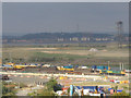
CTRL construction site
A view of the Channel Tunnel Rail Link construction site at Swanscombe in 2005. The actual CTRL runs in tunnel at this point just in front of the temporary surface lines with construction trains seen here.
Image: © Stephen Craven
Taken: 29 Oct 2005
0.07 miles


7

View east from Pilgrims Road, Swanscombe
Looking towards the twin chimneys of Tilbury Power Station in the distance.
Image: © Robin Webster
Taken: 25 Sep 2011
0.10 miles
8

All Saints, Swanscombe
Now converted into apartments.
Image: © Chris Whippet
Taken: 22 Dec 2009
0.11 miles

10

All Saints Church, Swanscombe (1)
This converted church is on the traffic light junction of A226 Galley Hill Road (on left) and B259 High Street (on right). It has been converted into several houses and flats.
Image: © David Anstiss
Taken: 22 Jul 2009
0.11 miles