
IMAGES TAKEN NEAR TO
The Woodlands, Lydyett Lane, NORTHWICH, CW8 4UP
Introduction
This page details the photographs taken nearby to The Woodlands, Lydyett Lane, CW8 4UP by members of the Geograph project.
The Geograph project started in 2005 with the aim of publishing, organising and preserving representative images for every square kilometre of Great Britain, Ireland and the Isle of Man.

There are currently over 7.5m images from over14,400 individuals and you can help contribute to the project by visiting https://www.geograph.org.uk
Image Map
Images are licensed for reuse under creativecommons.org/licenses/by-sa/2.0
Notes
- Clicking on the map will re-center to the selected point.
- The higher the marker number, the further away the image location is from the centre of the postcode.
Image Listing (30 Images Found)
Images are licensed for reuse under creativecommons.org/licenses/by-sa/2.0
Image
Details
Distance
1
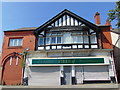
Barnton Co-op Store
Former branch of the Winnington Co-operative Society, opened in 1898
Image: © mike
Taken: 23 May 2018
0.07 miles
2

Old Direction Sign - Signpost by Hough Lane, Anderton
Pawn finial - 3 arms; Cheshire CCC octagonal in parish of Anderton with Marbury (Vale Royal District), Lydyett Lane junction with Hough Lane, Barnton.
To be surveyed
Milestone Society National ID: CH_SJ6475B
Image: © Milestone Society
Taken: Unknown
0.15 miles
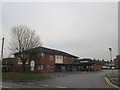
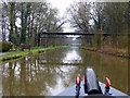
5
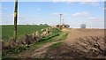
Field edge path
Marked as Bandshed Woods on maps - no sign of woodland.
Image: © Richard Webb
Taken: 5 Apr 2012
0.19 miles
6
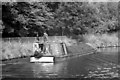
Working narrow boat on Trent & Mersey Canal (2)
Loaded narrow boat 'Mountbatten' of the Anderton Canal Carrying fleet heads towards Anderton along a length of the T&M which is cut into the side of the Weaver valley. It may be heading for Runcorn or Weston Point Docks in which case it will use the Anderton Lift to gain access to the Weaver Navigation which is 50ft below. At the docks 'Mountbatten' will moor alongside a ship & the cargo craned directly into the hold. Alternatively it may be heading south towards Middlewich & beyond.
Image: © Martin Tester
Taken: 5 Oct 1969
0.19 miles
7
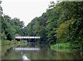
Trent and Mersey Canal south-west of Anderton, Cheshire
The footbridge connects Bestway Wood on the left with Nursery Wood on the right. A footpath allows walkers from Barnton access to the A533 Runcorn Road (to Northwich).
Image: © Roger D Kidd
Taken: 29 Aug 2011
0.19 miles
8
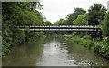
Footbridge Barnton
Trent and Mersey Canal, near Barnton. Provides access from housing estate to road down to Winnington Swing Bridge across River Weaver
Image: © Mike Todd
Taken: 16 May 2011
0.19 miles
9
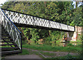
Barnton - canal footbridge
This footbridge over the Trent & Mersey Canal is part of the footpath that connects Nursery Road in Barnton with Winnington Swing Bridge. For an alternative view, please see Image
Image: © Dave Bevis
Taken: 22 Sep 2014
0.19 miles
10
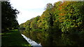
Trent & Mersey Canal at Bridge 200, Barnton
Image: © Colin Park
Taken: 1 Nov 2017
0.19 miles