
IMAGES TAKEN NEAR TO
Sunflower Way, NORTHWICH, CW8 4RS
Introduction
This page details the photographs taken nearby to Sunflower Way, CW8 4RS by members of the Geograph project.
The Geograph project started in 2005 with the aim of publishing, organising and preserving representative images for every square kilometre of Great Britain, Ireland and the Isle of Man.

There are currently over 7.5m images from over14,400 individuals and you can help contribute to the project by visiting https://www.geograph.org.uk
Image Map
Images are licensed for reuse under creativecommons.org/licenses/by-sa/2.0
Notes
- Clicking on the map will re-center to the selected point.
- The higher the marker number, the further away the image location is from the centre of the postcode.
Image Listing (4 Images Found)
Images are licensed for reuse under creativecommons.org/licenses/by-sa/2.0
Image
Details
Distance
1
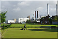
Winnington Park Recreation Club
The bowling green is being mowed in the morning with a backdrop of Winnington Works.
Image: © Stephen McKay
Taken: 13 Sep 2017
0.19 miles
2
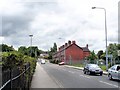
Winnington - view along the A533 (Winnington Lane)
Northwich (Winnington) - view along the A533 (Winnington Lane) from its junction with Winnington Avenue and next to Winnington soda ash works. Railings on the left form the boundary of Winnington Recreation Club sports ground.
Image: © Mike Harris
Taken: 15 Jun 2008
0.19 miles
3
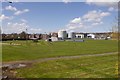
Cricket ground, Northwich
Off Park Road.
Image: © Richard Webb
Taken: 17 Apr 2016
0.21 miles
4
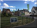
?Winnington Dale?
Building houses on a site of the chemical industry(and not so long before that, the fields of Moss Farm). A big industrial building was being demolished to the south.
Image: © Richard Webb
Taken: 2 Aug 2018
0.22 miles