IMAGES TAKEN NEAR TO
Keepers Lane, NORTHWICH, CW8 3BN
Introduction
This page details the photographs taken nearby to Keepers Lane, CW8 3BN by members of the Geograph project.
The Geograph project started in 2005 with the aim of publishing, organising and preserving representative images for every square kilometre of Great Britain, Ireland and the Isle of Man.

There are currently over 7.5m images from over14,400 individuals and you can help contribute to the project by visiting https://www.geograph.org.uk
Image Map
Images are licensed for reuse under creativecommons.org/licenses/by-sa/2.0
Notes
- Clicking on the map will re-center to the selected point.
- The higher the marker number, the further away the image location is from the centre of the postcode.
Image Listing (8 Images Found)
Images are licensed for reuse under creativecommons.org/licenses/by-sa/2.0
Image
Details
Distance
4
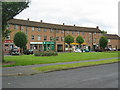
Lime Avenue shops, Weaverham
A neighbourhood group of shops built to serve the estate of council built houses developed in the late 1940's.
Image: © Lizzie
Taken: 12 Jun 2005
0.18 miles
5
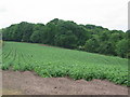
Potato field close to Owley Wood
Cheshire potatoes growing on the edge of the village of Weaverham.
Image: © Lizzie
Taken: 12 Jun 2005
0.18 miles
6
Owley Wood
On steep ground on the outside of a meander of the Weaver. Some seriously patronising anti cycling signs here. Imagine a country where they are illegal... I live in one.
Image: © Richard Webb
Taken: 2 Aug 2018
0.19 miles
7
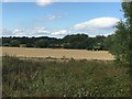
Combine, Weaverham
Some agricultural land remains amongst the salt industry. Barley being harvested from the Weaver flood plain.
Image: © Richard Webb
Taken: 2 Aug 2018
0.24 miles