IMAGES TAKEN NEAR TO
Denehurst Parkway, NORTHWICH, CW8 2UB
Introduction
This page details the photographs taken nearby to Denehurst Parkway, CW8 2UB by members of the Geograph project.
The Geograph project started in 2005 with the aim of publishing, organising and preserving representative images for every square kilometre of Great Britain, Ireland and the Isle of Man.

There are currently over 7.5m images from over14,400 individuals and you can help contribute to the project by visiting https://www.geograph.org.uk
Image Map
Images are licensed for reuse under creativecommons.org/licenses/by-sa/2.0
Notes
- Clicking on the map will re-center to the selected point.
- The higher the marker number, the further away the image location is from the centre of the postcode.
Image Listing (9 Images Found)
Images are licensed for reuse under creativecommons.org/licenses/by-sa/2.0
Image
Details
Distance
1
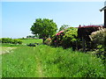
Home Farm to Cuddington Lane footpath
Heading east towards Cuddington Hall Farm, which is in the background.
Image: © John Topping
Taken: 6 Jun 2013
0.14 miles
2
Cooper Wood, Delamere Park (1)
Heading east on the Home Farm to Cuddington Lane path/track.
Image: © John Topping
Taken: 6 Jun 2013
0.17 miles
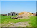
3
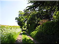
Approaching Cuddington Hall Farm
Heading east on the Home Farm to Cuddington Lane path/track.
Image: © John Topping
Taken: 6 Jun 2013
0.17 miles
4
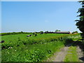
Cooper Wood, Delamere Park (2)
Heading west on the Cuddington Lane to Home Farm track/path, passing Cuddinton Hall Farm on the right.
Image: © John Topping
Taken: 6 Jun 2013
0.19 miles
5
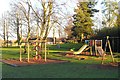
Delamere Park - The Green
View on a bearing of about 30° from the front of Long Acre housing.
The award-winning Delamere Park housing development was built mostly in the 1970s and 1980s on the site of Delamere House, family seat of the Wilbrahams. After the house was demolished, just before WW-II, it became an army camp and then a postwar camp for Polish displaced persons. The present-day housing surrounds the green (shown), with a residents' clubhouse just off the picture to the left.
Image: © Mike Harris
Taken: 19 Dec 2004
0.19 miles
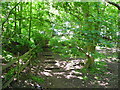
6
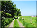
Cuddington Lane to Home Farm footpath
Heading west towards the woods north of Delamere Park.
Image: © John Topping
Taken: 6 Jun 2013
0.21 miles
7
Rear of Cuddington Hall Farm
Viewed from the Home Farm to Cuddington Lane track.
Image: © John Topping
Taken: 6 Jun 2013
0.21 miles
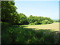
8
Woodland Path, Delamere park
Heading west on the Cuddington Lane to Home Farm footpath.
Image: © John Topping
Taken: 6 Jun 2013
0.24 miles
9
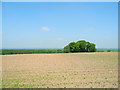
Farmland north of Delamere Park
Viewed from the Home Farm to Cuddington Lane footpath, looking north towards The Riddings.
Image: © John Topping
Taken: 6 Jun 2013
0.24 miles