IMAGES TAKEN NEAR TO
Bag Lane, NORTHWICH, CW8 2TR
Introduction
This page details the photographs taken nearby to Bag Lane, CW8 2TR by members of the Geograph project.
The Geograph project started in 2005 with the aim of publishing, organising and preserving representative images for every square kilometre of Great Britain, Ireland and the Isle of Man.

There are currently over 7.5m images from over14,400 individuals and you can help contribute to the project by visiting https://www.geograph.org.uk
Image Map
Images are licensed for reuse under creativecommons.org/licenses/by-sa/2.0
Notes
- Clicking on the map will re-center to the selected point.
- The higher the marker number, the further away the image location is from the centre of the postcode.
Image Listing (12 Images Found)
Images are licensed for reuse under creativecommons.org/licenses/by-sa/2.0
Image
Details
Distance
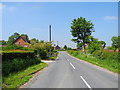
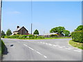
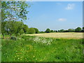
4
Delamere Way
Heading s/w towards a stile onto Bag Lane, Ruloe.
Image: © John Topping
Taken: 6 Jun 2013
0.04 miles
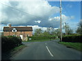
8
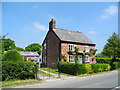
Holly Cottage, Ruloe
Viewed from Bag Lane.
Image: © John Topping
Taken: 6 Jun 2013
0.06 miles
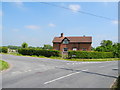
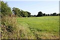
9
Delamere Way
Heading n/e from Bag Lane, Ruloe.
Image: © John Topping
Taken: 6 Jun 2013
0.06 miles
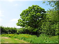
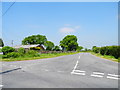
10
The Delamere Way at Ruloe
Heading north on the Delamere Way at Ruloe.
Wikipedia https://en.wikipedia.org/wiki/Delamere_Way
Image: © Jeff Buck
Taken: 11 Aug 2022
0.07 miles