IMAGES TAKEN NEAR TO
Tarporley Road, NORTHWICH, CW8 2EP
Introduction
This page details the photographs taken nearby to Tarporley Road, CW8 2EP by members of the Geograph project.
The Geograph project started in 2005 with the aim of publishing, organising and preserving representative images for every square kilometre of Great Britain, Ireland and the Isle of Man.

There are currently over 7.5m images from over14,400 individuals and you can help contribute to the project by visiting https://www.geograph.org.uk
Image Map
Images are licensed for reuse under creativecommons.org/licenses/by-sa/2.0
Notes
- Clicking on the map will re-center to the selected point.
- The higher the marker number, the further away the image location is from the centre of the postcode.
Image Listing (14 Images Found)
Images are licensed for reuse under creativecommons.org/licenses/by-sa/2.0
Image
Details
Distance
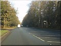
5
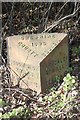
Old Milepost by the A49, south of Massey's Lodge
Cast iron post by the A49, in parish of Pulford (Chester District), Massey's Lodge; 100m South of entrance, against overgrown shrubbery. Cast iron CCC1896, erected by the County Council in the 19th century.
Inscription reads:-
: CUDDINGTON / 2 MILES / WEAVERHAM 3¾ / ACTON BRIDGE 5 : : CHESHIRE / 1896 / COUNTY COUNCIL : : TARPORLEY / 4½ MILES / BEESTON 6½ / NANTWICH 13¾ :
Maker:-
: W H SMITH & CO / MAKERS / WHITCHURCH :
Milestone Society National ID: CH_WAWC13
Image: © J Haynes
Taken: 30 Mar 2011
0.13 miles
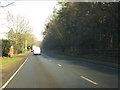
6
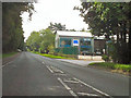
Whitegate Way, Oakmere
Passing beneath A49, Tarporley Road, in the direction of Kennel Bridge and Winsford.
Image: © Jo Lxix
Taken: 1 Jul 2006
0.18 miles
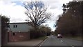
7
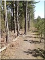
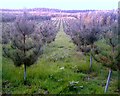
On the nature trail
At the edge of a tree nursery an established path makes for a dog walkers paradise.
Image: © Rob Rylands
Taken: 22 Apr 2010
0.19 miles
8
Tree Nursery, Oakmere
Forestry Commission Tree Nursery, off A49, Tarporley Road, and Hogshead Lane, Oakmere.
Image: © Jo Lxix
Taken: 24 May 2006
0.20 miles
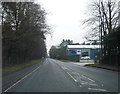
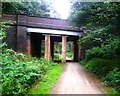
9
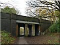
Tarporley Road bridge over the Whitegate Way
The bridge carries the A49. A flight of steps links the road to the trail. Since the railway tracks were lifted, concrete block walls and steel girders have been added to strengthen the deck. Image taken in 2006 shows it from the other side with this arrangement already in place.
Image: © Stephen Craven
Taken: 29 Dec 2021
0.21 miles