
IMAGES TAKEN NEAR TO
Ways Green, WINSFORD, CW7 4AS
Introduction
This page details the photographs taken nearby to Ways Green, CW7 4AS by members of the Geograph project.
The Geograph project started in 2005 with the aim of publishing, organising and preserving representative images for every square kilometre of Great Britain, Ireland and the Isle of Man.

There are currently over 7.5m images from over14,400 individuals and you can help contribute to the project by visiting https://www.geograph.org.uk
Image Map
Images are licensed for reuse under creativecommons.org/licenses/by-sa/2.0
Notes
- Clicking on the map will re-center to the selected point.
- The higher the marker number, the further away the image location is from the centre of the postcode.
Image Listing (5 Images Found)
Images are licensed for reuse under creativecommons.org/licenses/by-sa/2.0
Image
Details
Distance
1
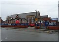
St. Chad's Church of England Primary and Nursery School
Image: © JThomas
Taken: 21 Mar 2024
0.18 miles
2
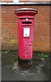
Elizabeth II postbox on Dingle Lane, Winsford
Postbox No. CW7 170.
See Image] for context.
Image: © JThomas
Taken: 21 Mar 2024
0.18 miles
3
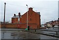
Houses on Dingle Lane, Winsford
Showing position of Postbox No. CW7 170.
See Image] for postbox.
Image: © JThomas
Taken: 21 Mar 2024
0.18 miles
4
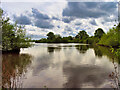
Weaver Navigation, Winsford Flash
The flash was formed from the mid-nineteenth century onwards due to subsidence caused by brine extraction. The flash, as seen today, was completed by 1887 where three brine streams converged and subsidence caused more than 100 acres of land to be flooded.
Image: © David Dixon
Taken: 9 May 2023
0.24 miles
5
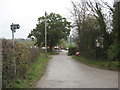
The end of the road --if you are driving
But walkers still have three options in Stocks Hill.
Image: © Dr Duncan Pepper
Taken: 13 Nov 2011
0.25 miles