
IMAGES TAKEN NEAR TO
Thrush Way, WINSFORD, CW7 3LN
Introduction
This page details the photographs taken nearby to Thrush Way, CW7 3LN by members of the Geograph project.
The Geograph project started in 2005 with the aim of publishing, organising and preserving representative images for every square kilometre of Great Britain, Ireland and the Isle of Man.

There are currently over 7.5m images from over14,400 individuals and you can help contribute to the project by visiting https://www.geograph.org.uk
Image Map
Images are licensed for reuse under creativecommons.org/licenses/by-sa/2.0
Notes
- Clicking on the map will re-center to the selected point.
- The higher the marker number, the further away the image location is from the centre of the postcode.
Image Listing (22 Images Found)
Images are licensed for reuse under creativecommons.org/licenses/by-sa/2.0
Image
Details
Distance
2
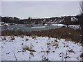
Frozen pond and large stockpile of road salt, Meadowbank Salt Mine
Image: © John Harrison
Taken: 19 Jan 2013
0.14 miles
3
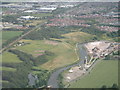
Winsford looking south east
Photo shows Wharton area of Winsford.The Weaver Navigation in the foreground and the Winsford Industrial Estate in the background
Image: © Ian Warburton
Taken: 3 Jul 2005
0.14 miles
5
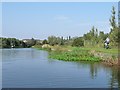
The River Weaver towpath - a traffic-free cycle route
The cyclist is heading north out of Winsford, towards Northwich.
Image: © Christine Johnstone
Taken: 14 Sep 2016
0.16 miles
6
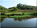
Towpath, east bank, Weaver Navigation
Running from Winsford to Northwich and mapped as a traffic-free cycle route.
Image: © Christine Johnstone
Taken: 14 Sep 2016
0.17 miles
7
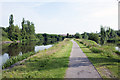
Looking North along the River Weaver
Image: © Richard Sandland
Taken: 8 Jul 2013
0.17 miles
8
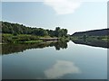
The navigable River Weaver, near Winsford
Looking upstream [locally south], with a cloud like a map of Africa reflected in the still waters.
Image: © Christine Johnstone
Taken: 14 Sep 2016
0.17 miles
9
Unknown structure, east bank, Weaver Navigation
Possibly the remains of a bridge?
Image: © Christine Johnstone
Taken: 14 Sep 2016
0.17 miles
10
Derelict wharf wall, Weaver Navigation
On the west bank, near the Winsford Rock Salt Mine.
Image: © Christine Johnstone
Taken: 14 Sep 2016
0.18 miles