
IMAGES TAKEN NEAR TO
Bradford Road, WINSFORD, CW7 2PF
Introduction
This page details the photographs taken nearby to Bradford Road, CW7 2PF by members of the Geograph project.
The Geograph project started in 2005 with the aim of publishing, organising and preserving representative images for every square kilometre of Great Britain, Ireland and the Isle of Man.

There are currently over 7.5m images from over14,400 individuals and you can help contribute to the project by visiting https://www.geograph.org.uk
Image Map
Images are licensed for reuse under creativecommons.org/licenses/by-sa/2.0
Notes
- Clicking on the map will re-center to the selected point.
- The higher the marker number, the further away the image location is from the centre of the postcode.
Image Listing (27 Images Found)
Images are licensed for reuse under creativecommons.org/licenses/by-sa/2.0
Image
Details
Distance
2
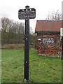
Rights of way disclaimer notice
The towpath downstream of this point is a public footpath, but upstream is private with permissive access. This old board, headed RWN (River Weaver Navigation) states the legal position more clearly.
Image: © Stephen Craven
Taken: 26 Dec 2011
0.14 miles
4
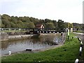
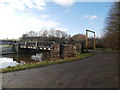
Newbridge swing bridge
This distinctive bridge spans the river Weaver and is situated at the site of the former Newbridge Locks which were swept away when the navigation was modernised in the 1880's. In the foreground can be seen the gate recess for one of the lock gates.
Image: © David Kitching
Taken: 16 Oct 2001
0.16 miles
6
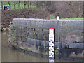
Headroom gauge
At first glance this looks like a river depth gauge, but actually it indicates the available headroom under a nearby bridge Image depending on water level.
Image: © Stephen Craven
Taken: 26 Dec 2011
0.17 miles
7
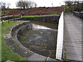
Swing bridge detail
A detail showing the recess into which the swing bridge Image fits.
Image: © Stephen Craven
Taken: 26 Dec 2011
0.17 miles
8
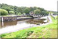
Swing Bridge
The River Weaver at Newbridge
Image: © Anthony O'Neil
Taken: 22 Aug 2019
0.17 miles
9

River Weaver, downstream of Newbridge Swingbrdge
On the left [west] the landing for boaters who need to open the swingbridge.
Image: © Christine Johnstone
Taken: 14 Sep 2016
0.18 miles
10

Swing bridge over the Weaver
One of a pair of swing bridges crossing the Weaver Navigation near Bradford Mill. It leads to a car park on the east bank, and is signed as a link path to National Cycle Route 5. A brief history of this site is given by another contributor at Image
Image: © Stephen Craven
Taken: 26 Dec 2011
0.18 miles